
Review of Micro-Simulation Models
Appendix D: Analysis of Tools
Table of Contents
This appendix describes in detail the answers supplied by the model designers to the simulator
form given in Appendix B. The first section gives comparative charts for transport telematics
functions available, objects and phenomena modelled, indicators provided and for other model
properties. Then, each simulator is described in ~2-3 pages. The 32 analysed models are listed in
Table 1.
Table 1: list of analysed micro-simulation models
| Model |
Organisation |
Country |
| AIMSUN2 |
Universitat Politècnica de Catalunya, Barcelona |
 |
| ANATOLL |
ISIS and Centre d'Etudes Techniques de l'Equipement |
 |
| AUTOBAHN |
Benz Consult - GmbH |
 |
| CASIMIR |
Institut National de Recherche sur les Transports et la Sécurité |
|
| CORSIM |
Federal Highway Administration |
 |
| DRACULA |
Institute for Transport Studies, University of Leeds |
 |
| FLEXSYT II |
Ministry of Transport |
 |
| FREEVU |
University of Waterloo, Department of Civil Engineering |
 |
| FRESIM |
Federal Highway Administration |
|
| HUTSIM |
Helsinki University of Technology |
 |
| INTEGRATION |
Queen's University, Transportation Research Group |
|
| MELROSE |
Mitsubishi Electric Corporation |
 |
| MICROSIM |
Centre of parallel computing (ZPR), University of Cologne |
|
| MICSTRAN |
National Research Institute of Police Science |
|
| MITSIM |
Massachusetts Institute of Technology |
|
| MIXIC |
Netherlands Organisation for Applied Scientific Research - TNO |
|
| NEMIS |
Mizar Automazione, Turin |
 |
| NETSIM |
Federal Highway Administration |
|
| PADSIM |
Nottingham Trent University - NTU |
|
| PARAMICS |
The Edinburgh Parallel Computing Centre and Quadstone Ltd |
|
| PHAROS |
Institute for simulation and training |
|
| PLANSIM-T |
Centre of parallel computing (ZPR), University of Cologne |
|
| SHIVA |
Robotics Institute - CMU |
|
| SIGSIM |
University of Newcastle |
|
| SIMDAC |
ONERA - Centre d'Etudes et de Recherche de Toulouse |
|
| SIMNET |
Technical University Berlin |
|
| SISTM |
Transport Research Laboratory, Crowthorne |
|
| SITRA-B+ |
ONERA - Centre d'Etudes et de Recherche de Toulouse |
|
| SITRAS |
University of New South Wales, School of Civil Engineering |
 |
| TRANSIMS |
Los Alamos National Laboratory |
|
| THOREAU |
The MITRE Corporation |
|
| VISSIM |
PTV System Software and Consulting GMBH |
|
Transport telematics functions
Numbers in Table 2 refer to the following transport telematics functions :
Index of Transport Telematics Functions
| 1 |
Co-ordinated traffic signals |
11 |
Dynamic route guidance |
2 |
Adaptive traffic signals |
12 |
Parking guidance |
3 |
Priority to public transport vehicles |
13 |
Public transport information |
4 |
Ramp metering |
14 |
Automatic debiting and toll plazas |
5 |
Motorway flow control |
15 |
Congestion pricing |
6 |
Incident management |
16 |
Adaptive cruise control |
7 |
Zone access control |
17 |
Automated highway system |
8 |
Variable message signs |
18 |
Autonomous vehicles |
9 |
Regional traffic information |
19 |
Support for pedestrians and cyclists |
10 |
Static route guidance |
20 |
Probe vehicles |
|
|
21 |
Vehicle detectors |
Table 2: Transport Telematics functions studied
|
1 |
2 |
3 |
4 |
5 |
6 |
7 |
8 |
9 |
10 |
11 |
12 |
13 |
14 |
15 |
16 |
17 |
18 |
19 |
20 |
21 |
| AIMSUN2
| X
| X
| -
| X
| -
| X
| X
| X
| -
| X
| X
| -
| -
| X
| -
| -
| -
| -
| -
| -
| X
|
| ANATOLL
| -
| -
| -
| -
| -
| -
| -
| -
| -
| -
| -
| -
| -
| -
| X
| -
| -
| -
| -
| -
| -
|
| AUTOBAHN
| X
| X
| -
| X
| X
| X
| X
| X
| X
| X
| X
| X
| -
| X
| X
| X
| X
| X
| -
| X
| X
|
| CASIMIR
| -
| X
| -
| -
| -
| -
| -
| -
| -
| -
| -
| -
| -
| -
| -
| -
| -
| -
| -
| -
| X
|
| CORSIM
| X
| X
| X
| X
| X
| X
| -
| -
| -
| -
| -
| -
| -
| -
| -
| -
| -
| -
| -
| -
| -
|
| DRACULA
| X
| X
| X
| -
| -
| -
| -
| -
| -
| -
| -
| -
| -
| -
| X
| -
| -
| -
| -
| -
| X
|
| FLEXSYT II
| X
| X
| X
| X
| X
| X
| X
| -
| -
| -
| -
| -
| -
| X
| -
| -
| -
| -
| X
| -
| X
|
| FREEVU
| -
| -
| -
| -
| -
| -
| -
| -
| -
| -
| -
| -
| -
| -
| -
| -
| -
| -
| -
| X
| X
|
| FRESIM
| -
| -
| -
| X
| X
| X
| -
| -
| -
| -
| -
| -
| -
| -
| -
| -
| -
| -
| -
| -
| X
|
| HUTSIM
| X
| X
| X
| X
| -
| -
| -
| X
| -
| X
| -
| -
| -
| X
| -
| X
| -
| X
| X
| X
| X
|
| INTEGRATION
| X
| X
| X
| X
| X
| X
| -
| X
| -
| X
| X
| -
| X
| X
| X
| -
| -
| -
| -
| X
| X
|
| MELROSE
| X
| X
| -
| X
| X
| -
| X
| -
| -
| X
| X
| -
| -
| X
| X
| X
| X
| X
| -
| X
| X
|
| MICROSIM
| -
| X
| -
| X
| -
| -
| -
| -
| -
| X
| X
| -
| -
| -
| -
| -
| -
| -
| -
| -
| -
|
| MICSTRAN
| X
| X
| X
| X
| -
| -
| X
| -
| -
| X
| X
| X
| -
| -
| X
| -
| -
| -
| -
| -
| X
|
| MITSIM
| X
| X
| -
| X
| X
| X
| -
| X
| -
| X
| X
| -
| -
| X
| -
| -
| -
| -
| -
| X
| X
|
| MIXIC
| -
| -
| -
| -
| X
| -
| -
| -
| -
| -
| -
| -
| -
| -
| -
| X
| X
| X
| -
| -
| -
|
| NEMIS
| X
| X
| X
| -
| -
| X
| X
| X
| -
| X
| X
| -
| -
| -
| -
| X
| -
| -
| -
| X
| X
|
| NETSIM
| X
| X
| X
| -
| -
| X
| -
| -
| -
| -
| -
| -
| -
| -
| -
| -
| -
| -
| -
| -
| X
|
| PADSIM
| X
| X
| -
| -
| -
| -
| X
| -
| -
| -
| X
| -
| -
| -
| -
| X
| -
| -
| -
| -
| X
|
| PARAMICS
| X
| X
| -
| X
| X
| X
| X
| X
| X
| X
| X
| -
| -
| X
| X
| -
| X
| -
| -
| X
| X
|
| PHAROS
| X
| -
| -
| -
| -
| -
| -
| -
| -
| -
| -
| -
| -
| -
| -
| -
| -
| -
| -
| -
| -
|
| PLANSIM-T
| X
| X
| X
| X
| -
| -
| X
| X
| X
| X
| X
| X
| -
| -
| X
| -
| X
| -
| -
| X
| -
|
| SHIVA
| -
| -
| -
| -
| -
| -
| -
| -
| -
| -
| -
| -
| -
| -
| -
| X
| X
| X
| -
| -
| X
|
| SIGSIM
| X
| X
| X
| X
| X
| X
| -
| -
| -
| -
| -
| -
| X
| -
| -
| X
| -
| X
| -
| X
| X
|
| SIMDAC
| -
| -
| -
| -
| -
| -
| -
| -
| -
| -
| -
| -
| -
| -
| -
| X
| -
| -
| -
| -
| -
|
| SIMNET
| X
| X
| X
| X
| -
| X
| -
| X
| -
| X
| X
| X
| -
| -
| -
| X
| -
| -
| -
| -
| X
|
| SISTM
| -
| -
| -
| X
| X
| -
| -
| X
| -
| X
| -
| -
| -
| -
| -
| -
| -
| -
| -
| -
| X
|
| SITRA-B+
| X
| X
| X
| -
| -
| X
| -
| -
| -
| X
| X
| X
| -
| -
| -
| -
| -
| -
| -
| X
| X
|
| SITRAS
| X
| X
| -
| -
| -
| X
| -
| -
| -
| X
| X
| -
| -
| -
| -
| -
| -
| -
| -
| -
| X
|
| THOREAU
| X
| X
| -
| X
| -
| -
| -
| X
| -
| X
| X
| -
| -
| -
| -
| -
| -
| -
| -
| X
| X
|
| VISSIM
| X
| X
| X
| X
| X
| -
| -
| -
| -
| -
| -
| -
| X
| -
| -
| -
| -
| -
| X
| X
| X
|
Note:
the answer of TRANSIMS to this question was : many of these will be implemented during the
next approximately 2 years.
Other functions provided :
| VISSIM | Automatic cruise control |
|---|
| Congestion warning for individual vehicle |
|---|
| SIMDAC | Anti-collision devices |
|---|
Objects and phenomena
Numbers in the comparative Table 3 below refer to the following objects and
phenomena:
Index of Objects and Phenomena
| 1
| Weather conditions
| 8
| Incidents
|
| 2
| Search for a parking space
| 9
| Public transports
|
| 3
| Parked vehicles
| 10
| Traffic calming measures
|
| 4
| Elaborate engine model
| 11
| Queue spill back
|
| 5
| Commercial vehicles
| 12
| Weaving
|
| 6
| Bicycles / motorbikes
| 13
| Roundabouts
|
| 7
| Pedestrians
|
|
|
Table 3: Objects and phenomena modelled
|
| 1
| 2
| 3
| 4
| 5
| 6
| 7
| 8
| 9
| 10
| 11
| 12
| 13
|
| AIMSUN2
| -
| -
| -
| -
| -
| -
| -
| X
| X
| -
| X
| X
| X
|
| ANATOLL
| -
| -
| -
| -
| -
| -
| -
| -
| -
| -
| X
| -
| -
|
| AUTOBAHN
| X
| -
| -
| X
| X
| -
| -
| X
| -
| X
| X
| X
| X
|
| CASIMIR
| -
| -
| -
| -
| -
| -
| -
| -
| -
| -
| -
| -
| -
|
| CORSIM
| -
| X
| X
| -
| X
| -
| X
| X
| X
| -
| X
| X
| X
|
| DRACULA
| X
| -
| -
| -
| X
| -
| -
| X
| X
| -
| X
| X
| X
|
| FLEXSYT II
| -
| -
| -
| -
| X
| X
| X
| X
| X
| X
| X
| X
| X
|
| FREEVU
| -
| -
| -
| X
| -
| -
| -
| -
| -
| -
| X
| X
| -
|
| FRESIM
| -
| -
| -
| -
| X
| -
| -
| X
| X
| -
| X
| X
| -
|
| HUTSIM
| -
| -
| -
| -
| -
| X
| X
| X
| X
| X
| X
| X
| X
|
| INTEGRATION
| -
| -
| -
| -
| X
| -
| -
| X
| X
| X
| X
| X
| X
|
| MELROSE
| -
| -
| X
| -
| X
| -
| X
| -
| -
| -
| X
| X
| -
|
| MICROSIM
| -
| -
| -
| -
| -
| -
| -
| -
| -
| -
| X
| -
| -
|
| MICSTRAN
| X
| -
| X
| -
| X
| -
| X
| -
| X
| -
| X
| X
| -
|
| MITSIM
| X
| -
| X
| X
| X
| -
| -
| X
| -
| X
| X
| X
| X
|
| MIXIC
| X
| -
| -
| X
| -
| -
| -
| -
| -
| X
| -
| X
| -
|
| NEMIS
| -
| -
| -
| X
| X
| -
| -
| X
| X
| X
| X
| -
| X
|
| NETSIM
| -
| X
| X
| -
| X
| -
| X
| X
| X
| -
| X
| X
| -
|
| PADSIM
| -
| -
| X
| -
| -
| -
| -
| -
| -
| -
| X
| -
| X
|
| PARAMICS
| X
| X
| -
| -
| X
| -
| -
| X
| X
| X
| X
| X
| X
|
| PHAROS
| -
| -
| -
| -
| -
| -
| -
| -
| -
| -
| X
| X
| X
|
| PLANSIM-T
| -
| -
| -
| -
| X
| -
| -
| -
| X
| -
| X
| X
| X
|
| SHIVA
| -
| -
| -
| -
| -
| -
| -
| -
| -
| -
| -
| X
| -
|
| SIGSIM
| -
| -
| X
| -
| X
| X
| -
| X
| X
| -
| X
| X
| -
|
| SIMDAC
| -
| -
| -
| -
| -
| -
| -
| X
| -
| X
| -
| -
| -
|
| SIMNET
| -
| -
| X
| X
| -
| -
| -
| X
| X
| X
| X
| -
| X
|
| SISTM
| X
| -
| -
| -
| X
| -
| -
| X
| -
| -
| X
| X
| -
|
| SITRA-B+
| -
| X
| X
| -
| X
| -
| -
| X
| X
| -
| X
| X
| X
|
| SITRAS
| -
| -
| -
| -
| X
| -
| -
| X
| -
| -
| X
| X
| -
|
| THOREAU
| X
| -
| X
| -
| -
| -
| X
| X
| -
| X
| X
| X
| X
|
| VISSIM
| -
| -
| X
| X
| X
| -
| X
| X
| X
| X
| X
| X
| X
|
Other objects and phenomena modelled:
| DRACULA | Guided buses |
|---|
| THOREAU | Pocket lanes and merge lanes |
|---|
| Choice and cusp lanes (branching options) |
|---|
| FLEXSYT II | Priority rules |
|---|
| SIMDAC | Detailed driver model |
|---|
| SIGSIM | Flow changes |
|---|
| TRANSIMS | 2, 5 and 9: planned |
|---|
| 3, 6, 7, 8, 10 and 13: possible |
|---|
| PARAMICS | Barred turns |
|---|
| High Occupancy Vehicle lanes |
|---|
| Signal Stacking Space |
|---|
| Turning lanes |
|---|
| Stay-in lanes |
|---|
| Road curvature |
|---|
| Gradient |
|---|
| Headway in tunnels, etc. |
|---|
Indicators
Symbols in the comparative table below refer to the following indicators:
Index of Indicators
| Objective
| Indicator
| Objective
| Indicator
|
|---|
| Efficiency:
| E1: modal split
| Safety
| S1: headway
|
|
| E2: travel time
|
| S2: overtaking
|
|
| E3: travel time variability
|
| S3: time-to-collision
|
|
| E4: speed
|
| S4: number of accidents
|
|
| E5: congestion
|
| S5: accident speed/severity
|
|
| E6: public transport regularity
|
| S6: interaction with pedestrians
|
|
| E7: queue length
| Comfort
| F1: physical comfort
|
| Environment
| V1: exhaust emissions
|
| F2: stress
|
|
| V2: roadside pollution level
| Technical
| T1: fuel consumption
|
|
| V3: noise level
| performance
| T2: vehicle operating costs
|
|
|
|
|
|
Table 4: indicators provided
|
| E1
| E2
| E3
| E4
| E5
| E6
| E7
| S1
| S2
| S3
| S4
| S5
| S6
| V1
| V2
| V3
| F1
| F2
| T1
| T2
|
| AIMSUN2
| X
| X
| -
| X
| -
| -
| X
| -
| -
| -
| -
| -
| -
| X
| -
| -
| -
| -
| X
| -
|
| ANATOLL
| -
| -
| -
| -
| -
| -
| -
| -
| -
| -
| -
| -
| -
| -
| -
| -
| -
| -
| -
| -
|
| AUTOBAHN
| -
| X
| X
| X
| X
| -
| -
| X
| -
| X
| X
| X
| -
| -
| -
| -
| -
| -
| -
| -
|
| CASIMIR
| -
| X
| -
| -
| -
| -
| X
| -
| -
| -
| -
| -
| -
| -
| -
| -
| -
| -
| X
| -
|
| CORSIM
| -
| X
| X
| X
| X
| -
| X
| -
| X
| -
| -
| -
| -
| X
| -
| -
| -
| -
| X
| -
|
| DRACULA
| -
| X
| X
| -
| -
| -
| -
| -
| -
| -
| -
| -
| -
| X
| -
| -
| -
| -
| X
| -
|
| FLEXSYT II
| -
| X
| X
| X
| X
| X
| X
| X
| -
| -
| -
| -
| X
| X
| X
| -
| -
| -
| X
| -
|
| FREEVU
| -
| X
| X
| X
| -
| -
| -
| -
| -
| -
| -
| -
| -
| -
| -
| -
| -
| -
| -
| -
|
| FRESIM
| -
| X
| X
| X
| -
| -
| -
| -
| X
| -
| -
| -
| -
| X
| -
| -
| -
| -
| X
| -
|
| HUTSIM
| -
| X
| X
| X
| X
| -
| X
| X
| -
| -
| X
| X
| X
| X
| -
| -
| -
| -
| X
| -
|
| INTEGRATION
| -
| X
| X
| X
| X
| -
| -
| -
| -
| -
| -
| -
| -
| X
| -
| -
| -
| -
| X
| -
|
| MELROSE
| -
| X
| -
| X
| X
| -
| X
| -
| -
| -
| -
| -
| X
| -
| -
| -
| -
| -
| -
| -
|
| MICROSIM
| -
| -
| X
| X
| -
| -
| -
| -
| -
| -
| -
| -
| -
| X
| -
| -
| -
| -
| -
| -
|
| MICSTRAN
| -
| X
| X
| X
| X
| X
| X
| X
| -
| -
| -
| -
| X
| -
| X
| X
| -
| -
| -
| -
|
| MITSIM
| X
| X
| X
| X
| X
| -
| X
| X
| X
| -
| -
| X
| -
| -
| -
| -
| -
| -
| -
| -
|
| MIXIC
| -
| X
| X
| X
| X
| -
| -
| X
| -
| X
| X
| X
| -
| X
| X
| X
| -
| -
| X
| -
|
| NEMIS
| -
| X
| X
| X
| X
| X
| X
| X
| -
| X
| -
| -
| -
| X
| -
| -
| X
| -
| -
| -
|
| NETSIM
| -
| X
| X
| X
| X
| -
| X
| -
| -
| -
| -
| -
| -
| X
| -
| -
| -
| -
| X
| -
|
| PADSIM
| -
| -
| -
| X
| X
| -
| X
| -
| -
| -
| -
| -
| -
| -
| -
| -
| -
| -
| -
| -
|
| PARAMICS
| -
| X
| X
| X
| X
| X
| X
| X
| X
| -
| -
| -
| -
| X
| -
| X
| -
| -
| X
| -
|
| PHAROS
| -
| -
| -
| -
| -
| -
| -
| -
| -
| -
| -
| -
| -
| -
| -
| -
| -
| -
| -
| -
|
| PLANSIM-T
| X
| X
| X
| X
| X
| X
| X
| -
| -
| -
| -
| -
| -
| X
| -
| -
| -
| -
| X
| -
|
| SHIVA
| -
| X
| -
| X
| X
| -
| -
| X
| X
| X
| -
| -
| -
| -
| -
| -
| -
| -
| -
| -
|
| SIGSIM
| -
| X
| X
| X
| X
| X
| X
| -
| -
| -
| -
| -
| -
| -
| -
| -
| -
| -
| -
| -
|
| SIMDAC
| -
| -
| -
| X
| -
| -
| -
| X
| -
| X
| X
| X
| -
| -
| -
| -
| X
| -
| -
| -
|
| SIMNET
| -
| X
| X
| X
| X
| -
| X
| -
| -
| -
| -
| -
| -
| X
| -
| -
| -
| -
| X
| -
|
| SISTM
| -
| X
| X
| X
| X
| -
| X
| X
| X
| -
| -
| -
| -
| -
| -
| -
| -
| -
| -
| -
|
| SITRA-B+
| -
| X
| X
| X
| X
| X
| X
| -
| -
| -
| -
| -
| -
| -
| -
| -
| -
| -
| -
| -
|
| SITRAS
| -
| X
| -
| X
| X
| -
| X
| -
| -
| -
| -
| -
| -
| -
| -
| -
| -
| -
| -
| -
|
| THOREAU
| -
| X
| X
| X
| X
| -
| X
| X
| -
| -
| -
| -
| -
| -
| -
| -
| -
| -
| -
| -
|
| TRANSIMS
| X
| X
| X
| X
| X
| X
| X
| X
| X
| -
| -
| -
| -
| X
| X
| -
| -
| -
| X
| X
|
| VISSIM
| X
| X
| X
| X
| X
| X
| X
| X
| X
| X
| -
| -
| X
| X
| -
| -
| -
| -
| X
| -
|
Other indicators provided:
| INTEGRATION | Efficiency | number of stops |
|---|
| CASIMIR | Efficiency | number of stops |
| THOREAU | Efficiency | time spent stopped or creeping |
| | amount of acceleration |
| SITRAS | Efficiency | VKT |
| | delay |
| AUTOBAHN | Safety | hard decelerations |
| Comfort | ACN |
| MIXIC | Safety | shock waves |
| SIGSIM | Efficiency | delay |
| | degree of saturation |
| VISSIM | Efficiency | transit delay due to signals |
| | passenger delay |
Other model properties
Numbers in the comparative chart below refers to the following model properties:
Index of Model Properties
| 1
| Sensible default values for key parameters are provided
|
| 2
| Key parameters can be user-defined
|
| 3
| Limited need for data acquisition
|
| 4
| Easy integration with other models
|
| 5
| Easy integration with other databases and Geographic Information System
|
| 6
| Approved by local / national transportation body
|
| 7
| Will run on a low cost non-specialist hardware, e.g. a PC rather than a UNIX box
|
| 8
| Quantify the typical execution speed (symbols used are F for faster, S for slower and a
number to quantify the speed e.g. F 1-3 means from 1 to 3 times faster than real-time)
|
| 9
| Graphical Network Builder
|
| 10
| Graphical Animation of Results
|
Table 5: other model properties
|
| 1
| 2
| 3
| 4
| 5
| 6
| 7
| 8
| 9
| 10
|
| AIMSUN2
| X
| X
| -
| X
| X
| -
| PC, UNIX
| -
| X
| X
|
| ANATOLL
| X
| X
| -
| -
| -
| ESCOTA
| PC
| F 100
| -
| -
|
| AUTOBAHN
| -
| X
| -
| X
| -
| -
| PC
| real-time
| -
| -
|
| CASIMIR
| X
| X
| X
| -
| -
| X
| PC
| -
| X
| -
|
| CORSIM
| X
| X
| X
| X
| -
| FHWA
| PC
| -
| -
| X
|
| DRACULA
| X
| X
| X
| X
| -
| -
| PC
| F 20
| -
| X
|
| FLEXSYT II
| X
| X
| -
| X
| -
| -
| PC
| F 10
| X
| X
|
| FREEVU
| X
| X
| X
| -
| -
| -
| PC
| S 50%
| -
| X
|
| FRESIM
| X
| X
| X
| -
| -
| X
| PC
| -
| -
| X
|
| HUTSIM
| X
| X
| X
| -
| -
| X
| PC
| F 1-5
| X
| X
|
| INTEGRATION
| X
| X
| X
| -
| -
| -
| PC, UNIX, VAX
| F 1-5
| -
| X
|
| MELROSE
| X
| X
| -
| X
| X
| -
| UNIX, LINUX
| F 14
| X
| X
|
| MICSTRAN
| X
| X
| X
| -
| -
| NPA
| UNIX
| F 5
| -
| -
|
| MITSIM
| X
| X
| X
| X
| X
| X
| PC, UNIX
| real-time
| -
| X
|
| MIXIC
| X
| X
| -
| -
| -
| X
| PC
| F 3
| -
| X
|
| NEMIS
| X
| X
| X
| -
| X
| X
| PC
| -
| -
| X
|
| NETSIM
| X
| X
| X
| X
| -
| FHWA
| PC
| -
| -
| X
|
| PADSIM
| X
| -
| X
| X
| X
| NTCC
| PC, UNIX
| F 3
| -
| X
|
| PARAMICS
| X
| X
| -
| X
| -
| -
| UNIX
| F 2
| X
| X
|
| PHAROS
| X
| X
| -
| -
| -
| -
| UNIX
| real-time
| -
| X
|
| PLANSIM-T
| X
| X
| X
| X
| -
| -
| UNIX
| -
| -
| X
|
| SHIVA
| X
| X
| X
| -
| -
| -
| UNIX
| real-time
| -
| X
|
| SIGSIM
| X
| X
| X
| X
| -
| -
| UNIX
| -
| -
| X
|
| SIMDAC
| -
| X
| X
| -
| -
| -
| UNIX
| F 5
| -
| X
|
| SIMNET
| X
| X
| -
| -
| -
| -
| UNIX, LINUX
| F 6
| -
| -
|
| SISTM
| X
| X
| -
| -
| -
| -
| PC
| F 5
| -
| X
|
| SITRA-B+
| -
| X
| -
| -
| -
| -
| PC, UNIX
| F 1-5
| -
| X
|
| SITRAS
| X
| X
| -
| -
| X
| -
| PC
| F 1-2
| -
| X
|
| THOREAU
| X
| X
| -
| -
| -
| -
| UNIX
| F 2-3
| -
| X
|
| TRANSIMS
| X
| X
| -
| -
| -
| -
| UNIX
| F
| -
| X
|
| VISSIM
| X
| X
| X
| -
| X
| GMT
| PC, UNIX
| real-time
| X
| X
|
Note:
The MICROSIM answer to question 7 was: portable to many platforms (SUN, HP, SGI, LINUX,
IBM-Risc).
Abbreviations used:
- FHWA: Federal Highway Administration (USA)
- NPA: National Police Agency (Japan)
- ESCOTA: Motorway Company (France)
- NTCC: Nottingham Traffic Control Centre
- GMT: German Ministry of Transport
Objective
Simulate urban and interurban traffic networks containing a wide range of advanced transport
telematics systems, providing to the user with a user friendly interface to facilitate both, the
model building and the use of simulation as an assessment tool.
Application field
Evaluation and testing of different traffic control systems (fixed, variable, adaptive) and different
management strategies (route guidance, VMS). Evaluation of alternative road designs is also easy
to perform through the graphical network editor. It is aimed at transportation consultants,
municipalities, road administrations, universities, public transport companies.
Technical approach
Network model : set of nodes and links (sections) decomposed into lanes and turnings from lane
to lane.
Traffic modelling : two possible traffic distribution models 1) input flows and turning
proportions 2) OD matrices and route choice models. Vehicle updating models : car-following
and lane changing (GIPPS)
Traffic control models : traffic lights, stop and yield signs, ramp metering.
Innovation
- graphical editing capabilities
- animation and simulation outputs
- simulator server: easy to communicate with external applications, i.e. adaptive control
systems
- two modelling approaches: flow and turning modifications based and route base (OD
matrices, paths)
State of the development
Started as a research product but recently became a commercial product.
Useful technical features
Network size: there is no theoretical limit to the size of the network. The execution speed will be
affected by the available (RAM) computer memory.
Network details: model lane by lane, turning movements from lane to lane. Accurate modelling
of intersection areas taking into account queue back blocking.
Vehicle representation: the user may define as many vehicle types as desired and provide the
vehicle parameters required. Sets of types, called classes, can be defined to group vehicle types.
Vehicle assignment: there are two approaches :
a) input vehicles in accordance to some input flows in some input links and distribute them in the
network following some turning percentages
b) generate trips from origins to destinations and distribute them following certain routes.
Control strategies and algorithms
UTC : fixed control is included (constant and variable plans) adaptive control should be external.
Route guidance and VMS are taken into account but the information or signalisation to
implement them must come from an external system.
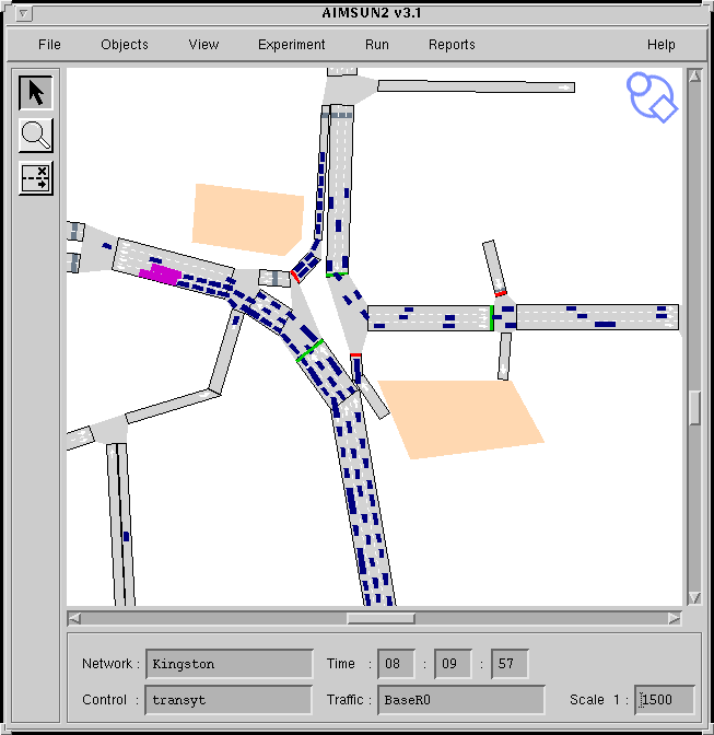
AIMSUN2 simulates an incident.
User interface
Graphical interface, windows based.
To edit and input networks
To manage experiments and view results (animation is also provided).
Validation and Calibration
AIMSUN2 was used in a pilot study of traffic management schemes on an environmental cell of
the city of Dublin, measured flows and speeds were used as calibration variables. The Center for
Transportation Studies of the University of Minnesota used AIMSUN2 in a simulation study of
the I-494 freeway in Minneapolis, again AIMSUN2 was validated and calibrated against the flow
and speed values provided by the detectors on the freeway. A large AIMSUN2 hybrid model of
urban freeways and service roads consisting of the Barcelona's Ring Roads and main accesses to
the city has been validated and calibrated using the observed flows and speeds. Quite recently the
Dutch company DHV, users of AIMSUN2 have conducted several simulation studies in some
Dutch cities (Maastrich, The Hague, Eindhoven, etc.) in which accurate calibrations of the
models have been conducted against real-world data. Also the Saudi consultant company Beeah
of Riyadh has used calibrated models of AIMSUN2 in its analysis of the transportation
conditions during the pilgrimage to Mecca.
Documentation user's guide
User's manuals are available for TEDI (Network editor) and AIMSUN2 (simulator).
Draft versions can be found at the FTP-site : potemkin.upc.es/pub/docs
Distribution
Currently being marketed by
U.P.C. - LIOS
c/Pau Gargallo 5
08028 Barcelona
Spain
Cost : 9000 ECUs
Education and research version : 3000 ECUs
For further details contact either
Jaime Barceló or Jaime Ferrer
LIOS
Department of Statistics and Operational Research
Universitat Politécnica de Catalunya
Pau Gargallo 5
08028 Barcelona
Spain
Telephone: +34-3-401-7033, Fax: +34-3-401-5881, E-Mail: barcelo@eio.upc.es
WWW: http://www-eio.upc.es/~lios/
Bibliography
Ferrer J.L. (1996) AIMSUN2, Version 2.1 User's manual , preliminary version. Universitat
Politechnica de Catalunya.
Barceló J. and Ferrer JL. (1994) Microscopic simulation of vehicle guidance systems with
AIMSUN2. XIIIth Euro Conference, Glasgow.
Barceló J., Ferrer J., Garcia D., Florian M., Le Saux E. (1996) The Parallelisation of AIMSUN2
microscopic simulator for ITS applications. 3rd World Congress on ITS, Orlando.
Barceló J., Ferrer J., Grau R, Florian M, Chabini, Le Saux E (1995). A Route Based Version of
the AIMSUN2 Micro-Simulation Model, 2nd World Congress on ITS, Yokohama.
Objective
Predict queues at toll booths
Application field
- Predict level of service at toll barrier
- Simulate strategies of toll operation
- Simulate strategies of toll enlargement
- Simulate strategies of ATC deployment
Technical approach
Microscopic simulation : each vehicle is given an arrival time, a type, a payment type, a service
time-change from queue to another is allowed. Dynamic change in both allocations or
closing/opening is managed. Queue lengths and waiting times are computed.
State of the development
Prototype, not yet commercial. Used for studies made by ISIS.
Useful technical features
Network size: currently 12 booths, queue lengths < 100 m easily extendible.
Vehicle representation: any class of vehicles (different statistical laws), lengths of vehicles (plus
headway in queues) are given as certain numbers of elementary boxes (1 box = light vehicles, 2
boxes = light goods vehicles, 3 boxes = HOVs....)
Vehicle assignment: when a vehicle enters the toll plaza, it is assigned to the shorter queue of the
booths corresponding to ITS payment type (Manual payment, automatic cash or card machine,
electronic toll collection...). In the course of queuing, the vehicle can join any adjacent shorter
queue, provided it corresponds to the same payment type when a booth closes, existing queuing
vehicles are assigned to the adjacent booth, conversely in case of an opening.
User interface
Text files (no graphics, nor dynamic presentation)
Validation and Calibration
Service time laws have been modelled from real field measurements according to the type of
vehicle, the type of payment, the type of the vehicle before, and according to the pressure on the
operator for manual booths and the name of the waiting time for automatic cash booths (time
available for drivers to prepare their coins).
Designer
ISIS company
Jean-Marc MORIN
11 avenue du Centre
78286 Guyancourt
France
Telephone: +33-1-30-484765, Fax: +33-1-30-484513, E-Mail: 100302.2032@compuserve.com.
ANATOLL was developed under a contract given to CETE de L'OUEST. It is not distributed yet.
Bibliography
Morin, J-M, Louah, G and Daviet, B, (1996) ANATOLL, A Software for Simulation and
Prediction of Queues at Toll Plazas: Characteristics and Evaluation, 3rd World Congress on
ITS, Orlando.
Objective
- To investigate the effects of ITS measures on traffic flow.
- To investigate the effects of traffic on intelligent vehicles.
Application field
Evaluation of all ITS measures especially those in involving intelligent vehicles.
Organisations :
- automotive industry and suppliers
- public bodies
Technical approach
- non-equipped vehicles : psycho-physiological spacing model
- equipped vehicles : any behaviour
- network of infrastructure modelled by different types of segments (e.g. junction straight,
gradients)
- speed limits, no-one-taking modelled by changes in behaviour.
Innovation
Any arbitrary behaviour of drivers and for systems can be included and assigned to variable
amounts of vehicles, for example. 50 % of vehicles are not equipped, 30 % have system A, 20 %
have system B. Possible because of object-oriented implementation.
State of development
Constantly in use.
Useful technical features
Network size : unknown (never reached the limit)
Network details :
- individual lanes
- "transfer" lanes on junction segments
- gradients
- special vehicle behaviour on conflict points (junctions)
- special vehicle behaviour for approaching + leaving traffic lights
Vehicle representation :
- passenger cars differentiated by power (max. acceleration and max. speed)
- commercial vehicles differentiated by power-to-mass ratio)
Control strategies and algorithms
Any strategy can be included but is implemented separately from the vehicle models.
User interface
- Input : text files
- Output : separate evaluation system giving diagrams and tables
Limitations
None encountered so far.
Validation and Calibration
- macroscopic by German measurement data
- microscopic in Daimler-Benz driving simulator
Documentation user's guide
Internal.
Distribution
Used only for consulting purposes.
Designer
Benz Consult GmbH
Kaiserstrasse 23
76131 Karlsruhe
Germany
E-Mail: Benz@s-direktnet.de
Bibliography
Benz, Thomas (1996) Automatic Distance Keeping in a High Speed Environment - ICC
Parameter Design, Proceedings of the Third ITS World Congress, Orlando, 1996.
Benz, Thomas (1996) ICC and Traffic flow - Mutual interactions, Traffic Technology
International.
Benz, Thomas : (1995) ASIS 4.0 : Flexible Microscopic Traffic Flow Simulation in Motorway
and Urban Networks, Workshop Proceedings "East-West Co-operation in Road Traffic
Operations", Prague, October 1995.
Benz, Thomas (1994) Traffic Flow Effects of Intelligent Vehicles, Traffic Technology
International.
Objective
Simulate the evolution of an isolated traffic junction to evaluate the energetic efficiency of
several control algorithms.
Technical approach
- time-sliced approach
- written in the MODULA 2 language
- Object-Oriented programming approach
State of development
No longer maintained by INRETS.
Useful technical features
Network size : 1 node, several lanes, few vehicles.
Vehicle representation. Only cars can be represented.
Control strategies and algorithms
- fixed time signal control
- real-time signal control
- several other traffic signal control algorithms
User interface
Graphic interface to choose junction type, control, demand and simulation parameters.
Validation and Calibration
Parameters come previous experimental studies.
Designer
Mr. Simon Cohen
INRETS, France
Bibliography
Cohen Simon, CASIMIR : un outil de simulation comparative du fonctionnement des carrefours
ŕ feux isolés, RTS, n 26, juin 1990
Cohen Simon, Traffic control simulation at isolated junctions, RTS, English issue, n 7, 1991
Objective
CORSIM (CORridor microscopic SIMulation) is a combination of two other micro-simulators;
the urban micro-simulator NETSIM and the freeway micro-simulator FRESIM. This has resulted
in a simulation model that is capable of representing traffic flow in large urban areas containing
both surface streets and freeways.
Application field
CORSIM is aimed at the development and evaluation of Transportation Systems Management
(TSM) strategies. To test the effect of TSM schemes on trip patterns it is necessary to analyse an
area that contains a substantial portion of the routes that the trip makers follow.
CORSIM is aimed at traffic planners and engineers.
Technical approach
For the CORSIM model, which contains both the NETSIM and FRESIM models, the spatial
extent of the traffic environment is defined as a set of "sub-networks," which reflect the concept
of network partitioning.
In a multiple-model network, each of the component models of CORSIM simulates a different
sub-network. The interfacing of adjoining sub-networks is accomplished by defining "interface
nodes", which represent points at which vehicles leave one sub-network and enter another. Nodes
of this type are assigned special numbers to distinguish them from other nodes in the network.
The terms "entry interface links," which receive traffic from the adjoining sub-networks, and
"exit interface links," which carry traffic exiting the sub-network to adjoining sub-networks, are
used to describe links at the boundaries of the sub-networks.
The freeway sections can be modelled with FRESIM, while the urban sub-network can be
modelled with NETSIM. Other sub-networks will be processed in a similar manner. Once the
user identifies the appropriate sub-network representation, all interfacing processes are handled
internally by the model by the interface logic.
Innovation
Combining the capabilities of NETSIM and FRESIM.
State of development
Has recently been released as a commercial product by the FHWA. As well as the released
version of CORSIM the FHWA also has other versions of the program in order to perform
several ongoing R&D projects such as the development of Real-Time Traffic Adaptive Control
Systems, Dynamic Traffic Assignment Evaluation Systems etc. These versions are specifically
designed to address ITS-oriented issues.
Useful technical features
Network size. NETSIM sub-network limitations: Maximum numbers of nodes: 250, links: 500,
vehicles: 10000, buses: 256, bus stations: 99, bus routes: 100, actuated controllers: 100,
detectors: 300. FRESIM sub-network limitations Maximum number of nodes: 350, links: 600,
vehicles: 10000, buses: 200, bus routes: 100, detectors: 300, incidents: 20, ramp metering signals:
150. It is planned to remove the restrictions on network size and vehicle numbers soon.
Network details. See NETSIM and FRESIM responses.
Vehicle representation. See NETSIM and FRESIM responses.
Vehicle assignment. Traffic assignment of O-D data is possible for the NETSIM model but not
for the FRESIM model.
Control strategies and algorithms
Pre-timed and actuated signal control can be modelled. Models four different types of on-ramp
freeway metering (clock-time, demand/capacity, speed control and gap acceptance merge
control)
User interface
Input and output is via ASCII text files. However tools exist to graphically create these input files
and display results. (See FRESIM and NETSIM responses)
Limitations
See NETSIM and FRESIM responses.
Validation and Calibration
See NETSIM and FRESIM responses.
Contact/Distribution Details
For further technical information contact:
Henry Lieu
Federal Highway Administration
Turner Fairbank Highway Administration Research Center
6300 Georgetown Pike
McLean VA22101
USA.
E-Mail: Henry.Lieu@fhwa.dot.gov
For distribution see the FRESIM or NETSIM responses.
Bibliography
Nsour, S and Santiago, A (1994) Comprehensive Plan Development For Testing, Calibration
And Validation Of CORSIM. Proceedings of the 64th ITE Annual Transportation Engineers.
Held: Dallas, Texas, pp486-490, Report No: PP-042
Cragg, CA and Demetsky, MJ (1995) Simulation Analysis Of Route Diversion Strategies For
Freeway Incident Management. Final Report. Virginia Transportation Research Council, Report
No: VTRC 95-R11; Proj No. 3046-030-940.
Detailed information on CORSIM can be found at the WWW site:
http://www.fhwa-tsis.com
A manual is available via anonymous ftp at www.fhwa-tsis.com in the CORSIM directory.
Objective
To provide a computer-based urban traffic network model framework to simulate the day-to-day
evolution of, say, a peak period, with the emphasis on individual choices and individual vehicle
movements, to test fundamental issues of network modelling, and to assess future transport
strategies including real-time systems and complex behaviour. To provide a flexible modelling
framework whereby new research results can be readily incorporated; for example, new
behavioural rules describing the response to real-time strategies may be incorporated when the
data becomes available.
Application field
DRACULA is suited for testing real-time policies that deal specifically with variability, such as:
- assessing the effect of traffic management strategies on public transport;
- evaluating different UTC control strategies;
- looking at day-to-day and within-day variation in traffic;
- representing and evaluating congestion pricing strategies;
- examining strategies aimed at reducing fuel consumption and
- exhaust emissions.
It is also suited for measuring reliability within a modelling framework, and for testing certain
basic assumptions of macroscopic models.
Technical approach
The supply sub-model of DRACULA consists essentially of a micro-simulation of movement of
vehicles through a network, under pre-specified network supply conditions for the day. The
network supply conditions may vary from day-to-day and within-day on a global-basis due to
effects such as weather and lighting and at the local level due to incidents (such as road works,
breakdowns) on part of a network and for a limited period of time.
The traffic micro-simulation model is written in the C language. It is a time-based simulation,
with change of vehicle states at discrete intervals of 1 sec. Vehicles are individually represented;
their movements in a network are governed by a car-following model, a lane-changing model and
traffic regulations on the road. Public transport is represented with reserved lanes, bus stops and
bus lay-bys being modelled.
The traffic signals used are fixed-plan or adaptive according to prevailing traffic condition or to
priorities for public transport. The traffic condition is supplied by detectors on the roads.
Innovation
DRACULA is a totally new modelling framework in which variability effects and the differences
between drivers and between days are explicitly recognised from the beginning and the behaviour
of drivers and vehicles are represented. Contrary to most of existing models, both the demand
sub-model (where drivers' route choice, departure time choice and network learning process are
simulated) and the supply sub-model (which simulates vehicle movements through the network)
of DRACULA are based on micro-simulation and both evolve from day-to-day.
The traffic model is linked to a pollution model which captures the vehicles sec-by-sec
movement and calculates fuel consumption and exhaust emissions for each individual vehicle.
State of development
DRACULA has been developed since 1993 and has been used mainly for research purposes. It
has a direct link with SATURN in the sense that DRACULA can use the network and route
assignment from SATURN.
It is under development to include public transport such as guided bus and park & ride, and
traffic control algorithms for public transport priority.
Useful technical features
Network size. The largest network tested with DRACULA so far is one in north Leeds, which
consists of some 180 nodes, 400 links and 23,000 trips in a one-hour morning peak.
Network details. The network is modelled as a set of nodes, links and lanes. A node can be either
internal (an intersection) or external (a source or sink node for traffic coming in or leaving the
network). An intersection can be modelled as signalised, give-away, or roundabout; there is no
restriction on the number of bi-directional branches to an intersection. Vehicles travel though an
intersection along "inter-lanes" which connects the stopline of an incoming lane with the entry of
a leaving lane.
Vehicle representation. Vehicles are individually represented; each has individual characteristics
such as its type, size, acceleration and deceleration capability, the driver's desired speed etc.
Public transport vehicles are represented by service number, fixed route, service frequency, bus
stops and dwell time (average and variation) at each bus stop.
Vehicle assignment. Vehicles follow pre-defined fixed routes through the network; the
assignment is carried out externally before the simulation using either the DRACULA day-to-day
demand model or the equilibrium assignment model of SATURN. Vehicles arrive at the network
at either pre-defined departure times, or randomly according to a shifted-negative exponential
headway distribution. The trip matrix for a given day may be either a random sample from an
“average” matrix or derived from the explicit day-to-day evolutionary model. Similarly within
day departure times are either randomly generated from a profile or explicitly selected by the
demand model.
Control strategies and algorithms
The signal control algorithms are all internal; it has not been linked to any real system such as
SCOOT or SPOT or PRODYN.
User interface
Input files are plain text; SATURN input files can be used. Output is a combination of text files
and an animated screen display of the simulation.
Limitations
No automatic procedures for multiple runs to investigate variability.
Needs improved graphics and links to GIS and analysis packages, better validated parameters and
a model for route choice following an incident.
Validation and Calibration
DRACULA has been tested on a number of SATURN networks and the travel performance such
as delays and speed are compared with those from the calibrated SATURN models. Further
calibration is expected to be carried out in the next few months in two projects involving traffic
management measures for kerb guided bus and park & ride schemes.
Contact/Distribution Details
For further details contact any of the following
Ronghui Liu, Dirck Van Vliet, Dave Watling
Institute for Transport Studies
University of Leeds
Leeds
LS2 9JT
UK
Telephone: +44 (0)113 343 5338, fax: +44 (0)113 343 5334, E-Mail: rliu@its.leeds.ac.uk
DRACULA has only used within ITS so far, but is available for use on research projects. Contact
Dirck Van Vliet above if you are interested in obtaining a copy.
Bibliography
Liu, R., (1994) DRACULA microscopic traffic simulation, ITS Working Paper 431, Institute for
Transport Studies, University of Leeds.
Liu, R., Van Vliet, D. and Watling, D. (1995a) DRACULA: Dynamic Route Assignment
Combining User Learning and Micro-simulation, Paper presented at PTRC, Vol. E, pp 143-152.
Liu, R., Van Vliet, D. and Watling, D.P. (1995b) DRACULA -Microscopic, Day-to-Day
Dynamic Modelling of Traffic Assignment and Simulation, Proceedings of the 4th International
Conference, Capri, pp. 444-448, (June 1995).
Liu, R. and Van Vliet, D. (1996) DRACULA - a Dynamic Microscopic Model of Road Traffic,
Proceedings of the International Transport Symposium, Beijing, July 1996, pp. 160-170.
MARGOT Consortium (1994). Advanced multirouteing guidance. Deliverable 6017 of DRIVE
II Project LLAMD, MARGOT Sub-project.
Sorah, H., Timms, P.M. and Watling, D.P. (1994). Modelling the day-to-day dynamics of route
choice and traffic control. Presented at the 7th Conference on Travel Behaviour, Santiago,
Chile, June 13-16, 1994.
Timms, P.M. and Watling, D.P. (1996) Modelling Traffic Assignment with Driver Information
under Day-to-day Variability. 13th Annual Meeting of Transport Research, Link`ping, January,
1996.
Timms, P.M. and Watling, D.P. (1997). Modelling traffic assignment with driver information
under day-to-day variability. In preparation for submission to Transportation Research C.
Timms, P.M., Watling, D.P. and Liu, R. (1997) A Calibration Manual for DRACULA. Institute
for Transport Studies, Working Paper 478, University of Leeds.
Van Vliet, D. (1996) Dynamic Traffic Assignment: Equilibrium vrs Micro-simulation. Paper
presented at the 1996 Optimisation Days, University de Montreal, May 1996.
Watling, D.P. (1995) DRACULA 1.0: User guide to the day-to-day model, ITS Technical Note
369, Institute for Transport Studies, University of Leeds.
Objective
The objective of FLEXSYT is to analyse the effect of several dynamic traffic management
strategies, including traffic signal settings for networks (any type), ramp metering, structure of
the network, toll -plaza's, lane for special road users (bus lanes, truck lanes, HOV-lanes) and
furthermore any type of control strategy one can think of.
Application field
The simulator can predict the effects of a certain control strategy or compare different strategies.
The model is used by road authorities, consultants, universities and manufacturers of traffic
control equipment.
Technical approach
FLEXSYT-II is event-based: only changes of state of vehicles, detectors and signals are
calculated. Vehicles move through the network on a stochastic base. The network is divided into
segments which can have a number of attributes such as stop lines. Vehicles accelerate and
decelerate and react on each other and their environment. Traffic control is simulated with a
special traffic control programming language, called FLEXCOL-76.
Innovation
The most important differences with other microscopic simulators is the possibility to use a
special traffic control programming language, with which it is possible to simulate any type of
control and the fact that the simulator is fully event based.
State of development
FLEXSYT II is a commercial product. At this moment, is has 38 users. The current version is
2.4.
Useful technical features
Network size: in a simulation 10 000 vehicles can be present simultaneously, but this number
depends on the memory available and can be extended easily.
Network details: the network is divided into segments, parts of roads with a width of one lane.
These segments have attributes, representing several aspects of such as bus stops, stop lines,
detectors, unsignalized conflicts, not queuing zones, etc.
Vehicle representation: there are eight types of vehicles, each with certain characteristics, which
can be adjusted by the user. 1. person cars, 2. small trucks, 3. large trucks 4. buses 5. trams 6.
bicycles 7. pedestrians 8. HOV vehicles
Vehicle assignment: in the model, there is no assignment, other than specified by the user via a
time-dependent 0D-matrix for every intersection.
Control strategies and algorithms
Any type of control strategy (UTC) can be simulated.
User interface
At this moment, a graphical user interface is under development. A final version is tested by a
small user group. With this interface, input can be edited and the simulation can be monitored.
Limitations
- No assignment
- Small networks
Validation and Calibration
The model was validated for three different situations : a single intersection , a roundabout and a
motorway with bottleneck. This validation has to lead to changes in the model. At this moment, a
second validation takes place.
Documentation user's guide
A user manual is available.
Distribution
H. TAALE
Transport Research Centre (AVV)
PO Box 1031
3000 BA Rotterdam - The Netherlands
Telephone : +31 10 282 58 81, Fax: +31 10 282 5842, E-Mail: H.Taale@avv.rws.minvenw.nl
Bibliography
Middelham F., T.C. Wang, R. Koeijvoets and H. Taale (1994) FLEXSYT-II- manual (part 1 and
2). Transport Research Centre (AVV), Rotterdam.
Taale H., and Middelham F., (1997) FLEXSYT-II- A validated Microscopic Simulation Tool
paper for the 8th IFAC/IFIP/IFORS Symposium on Transportation Systems. June 1997, Chania,
Greece (to be published).
Vlemmings, T. (1995) Validation FLEXSYT-II-, Final Report. Report for the Transport Research
Centre (AVV). DHV Environment and Infrastructure, Amersfoort.
Objective
The FREEVU model was developed at the University of Waterloo over a 2 year period (1988 -
1990) for the specific purpose of estimating the impact of trucks on freeway traffic streams. The
FREEVU model is a microscopic car-following model that is based on the car-following models
originally incorporated into the FHWA model INTRAS
Application field
The FREEVU model was developed primarily as a research tool. It is able to simulate linear
freeway systems only, including on and off-ramp, vertical curvature, number of lanes, vehicle
operating characteristics (e.g. weight to horsepower ratio, vehicle length), and driver
aggressiveness.
Technical approach
The FREEVU model is an extension and enhancement of a PC based version of the FHWA
INTRAS model, which is also a predecessor of the current FHWA FRESIM/CORSIM models.
FREEVU is limited to the modelling of linear freeway systems, such that route selection is not
considered. The model is based on car-following logic which incorporates collision avoidance
rules. Mandatory and discretionary lane changing is modelled in detail. In particular, the
discretionary lane changing logic is extensive, consisting of various probabilistic driver decision
models. As the objective of developing the model was to assess the impact of trucks, vehicle
operating characteristics are modelled in detail. The user has the opportunity to define the
composition of the traffic stream in terms of the operating characteristics of vehicles (e.g. weight,
engine horsepower, frontal area, coefficients of aerodynamic drag, length, maximum acceleration
and deceleration rates). The simulation incorporates a graphical depiction of the individual
vehicles within the traffic stream, as well as a user-friendly data input environment.
Innovation
The modelling of probabilistic driver decisions within the discretionary lane changing process.
The explicit modelling of vehicle operating characteristics such as weight, engine horsepower,
frontal area, coefficients of aerodynamic drag, length, maximum acceleration and deceleration
rates. The modelling of roadway vertical curvature.
State of development
The model was developed as a research tool and cannot currently be considered as a commercial
product.
Useful technical features
Network size : the latest version (1990) has the following restrictions: Section length (10 km);
Traffic lanes (8); Origins (20); Destination (20); Detectors (20); Vehicle types (100); Concurrent
vehicles on system (2500)
Network details : the movements of individual vehicles are modelled each second. Each lane on
the freeway is represented as are the vertical alignment, and the speed limit.
Vehicle representation : the user may define up to 100 different vehicle types in the traffic
stream. Each vehicle type is classified by its mass, engine power, frontal area, probability of
appears in the traffic stream, vehicle length, and desired speed.
Vehicle assignment : vehicles are generated at each origin zone and traverse the network en-
route to their destination. Since the model is only applicable to linear systems, no route choice
mechanism must be considered.
Control strategies and algorithms
No control strategies are presented included within the model.
User interface
The current interface is a user-friendly menu driven environment, which aids the user in creating
the necessary input data files. Having created the input files, the user may initiate a simulation,
and examine the graphical results from within this same environment.
Validation and Calibration
The car-following model was validated and calibrates as part of the INTRAS development. The
lane changing logic and vehicle operating characteristics incorporated into FREEVU have been
validated against field data from Canada and the USA.
Documentation user's guide
Documentation consists of a User's Guide, included as part of report entitled “FREEVU - A
Computerised Freeway Traffic Analysis Tool” by Bruce Hellinga and John Shortreed (TDS-91-
01). This report is published by the Research and Development Branch of the Ontario Ministry
of Transportation. Copies of the report may be obtained by contacting The Editor, Technical
Publications Room 320, Central Building 1201 Wilson Avenue Downsview, Ontario Canada
M3M 1J8
Distribution
The simulation model is not commercially available.
Designer
Dr. Bruce Hellinga and Dr. John Shortreed developed the model at the University of Waterloo,
Department of Civil Engineering Waterloo, Ontario Canada N2L 3G1
Objective
FRESIM (FREeway micro-SIMulator) is a microscopic freeway simulation model that models
each vehicle as a separate entity.
Application field
The FRESIM model is capable of simulating most of the prevailing freeway geometrics, which
include the following:
- One to five through-lane freeway mainlines, with one- to three-lane ramps and one- to three-
lane interfreeway connectors
- Variations in grade, radius of curvature, and superelevation on the freeway
- Lane additions and lane drops anywhere on the freeway
- Freeway blockage incidents
- Work zones through the use of the blockage incident capability of the model
- Auxiliary lanes, which are used by traffic to begin or end the lane-changing process or to
enter or exit the freeway.
The model also provides realistic simulation of operational features, which include the following:
- A comprehensive lane-changing model
- Clock-time and traffic-responsive ramp metering
- Comprehensive representation of the freeway surveillance system
- Representation of nine different vehicle types, including two types of passenger cars and four
types of trucks, each having its own performance capabilities
- Differences in driver habits, which are modelled by defining 10 different driver types,
ranging from timid drivers to aggressive drivers
Technical approach
The behaviour of each vehicle is represented in the model through interaction with its
surrounding environment, which includes the freeway geometry and other vehicles.
The FRESIM model is a considerably enhanced and reprogrammed version of its predecessor, the
INTRAS model. The enhancements include improvements to the geometric representation as
well as the operational capabilities of the INTRAS model. As a result, FRESIM simulates more
complex freeway geometries and provides a more realistic representation of traffic behaviour
than INTRAS. These enhancements have also resulted in a more flexible and user-friendly
model.
Innovation
- Heavy vehicle movements may be biased or restricted to certain lanes
- Vehicles' reaction to upcoming geometric changes; the user can specify warning signs to
influence the lane-changing behaviour of vehicles approaching a lane drop, incident, or off-
ramp.
State of development
FRESIM is a commercial product.
Useful technical features
Network size. Maximum number of nodes: 350, links: 600, vehicles: 10000, buses: 200, bus
routes: 100, detectors: 300, incidents: 20, ramp metering signals: 150.
Vehicle representation. Nine different vehicle types are allowed. Vehicle type characteristics
include vehicle length, maximum acceleration and deceleration.
Vehicle assignment. Assignment is not done by FRESIM.
Control strategies and algorithms
Models four different types of on-ramp freeway metering (clock-time, demand/capacity, speed
control and gap acceptance merge control)
User interface
Input and output is via ASCII text files. However tools exist to graphically create these input files
and display results.
ITRAF (Interactive traffic network data editor for the integrated TRAFfic simulation system
[TRAF]) is an interactive computer program with a graphical interface developed to simplify and
speed up the task of creating the data files that serve as input to the TRAF family of traffic
models.
The program permits the creation of new data files as well as the editing of existing ones.
Because of its graphical interface, ITRAF eliminates the need to remember and understand
"record types," thus greatly reducing the chances of making errors during the input process.
Moreover, ITRAF has built-in comprehensive and smart error checking that ensures the
consistency and accuracy of the data. At present, ITRAF is still a prototype.
TRAFVU is an interactive graphics processor designed to display and animate the results of
FRESIM simulations. TRAFVU provides an intuitive window environment to view selected
input data and all output generated by FRESIM. Designed and implemented to maximise
portability, TRAFVU will execute in conjunction with a variety of operating systems on both PC
and UNIX platforms. The Windows version of TRAFVU is distributed as part of, and is designed
to operate efficiently in conjunction with, FHWA's TSIS package.
TRAFVU enables the user to animate traffic simultaneously in multiple views of the same or
different traffic networks under the same or differing traffic conditions. It provides a user-friendly
environment that allows the user to analyse the multitude of simulation-produced metrics via
several presentation formats, including line graphs, tables, and specialised controller diagrams.
TRAFVU is suitable for traffic operations analysis as well as the presentation of "before and
after" studies to convince the audience of the utility of simulation results.
Limitations
Although FRESIM is the most powerful and detailed freeway simulation model developed thus
far by FHWA, it has some limitations that may restrict its application for certain freeway
operations studies. For instance, there is no direct capability for representing HOV operations,
and there is no direct modelling of the effect of reduced lane width.
Validation and Calibration
FRESIM has been calibrated and validated for freeway conditions throughout the US. See the
bibliography for more details. Most of the default values have been calibrated and validated
based on mid 80's field observation data.
Contact/Distribution Details
For further technical information contact:
Henry Lieu
Federal Highway Administration
Turner Fairbank Highway Administration Research Centre
6300 Georgetown Pike
McLean VA22101
USA.
E-Mail: Henry.Lieu@fhwa.dot.gov
Distributed by McTrans.
McTrans: (352) 392-0378 (Call for information, technical assistance)
Voice Messages: (800) 226-1013 (Leave a message 24-hours for a return call)
McFAX: (352) 392-3224 (Fax orders, requests or other correspondence)
McLink: (352) 392-3225 (Access our BBS to download files and post/receive messages)
E-mail: mctrans@ce.ufl.edu (Access through the Internet)
WWW: http://www-uftrc.ce.ufl.edu/info-cen/info-cen.htm
and PC-Trans
Kansas University Transportation Center
2011 Learned Hall
Lawrence, KS 66045
Voice: +1-913-864-5655
Fax: +1-913-864-3199
BBS: +1-913-864-5058
WWW: http://kuhub.cc.ukans.edu/~pctrans
FRESIM, Ver. 5.0: $250
Documentation: $25
Bibliography
Barnes KE (1993) An Alternative Method For Analyzing Merge/Diverge And Weaving Areas On
Freeways With Four Or More Directional Lanes. Interim Report. FHWA/TX-94/1232-19.
Dixon KK, Lorscheider A and Hummer JE (1995) Computer Simulation Of I-95 Lane Closures
Using FRESIM. Proceedings of the 65th ITE Annual Meeting.
Gilmore JF, Roth SP, Forbes HC and Payne KA (1995) ATMS Universal Traffic Operation
Simulation. Proceedings of the 1995 Annual Meeting of ITS America,Washington, D.C. Held:
15th-17th March 1995, pp403-411.
Jacobson EL (1992) Evaluation Of The TRAF Family Of Models; Testing Of The CORFLO And
FRESIM Models. Final Report. WA-RD 282.1; Contract/Grant Number: GC8286; Task 17
Liu CC, Kanaan A, Santiago AJ and Holt G (1992) Macro Vs. Micro Freeway Simulation: A
Case Study. Institute of Transportation Engineers Annual Meeting. Washington, D.C. 1992.
Nsour, S and Santiago, A (1994) Comprehensive Plan Development For Testing, Calibration
And Validation Of CORSIM. Procedings of the 64th ITE Annual Transportation Engineers. Held:
Dallas, Texas, pp 486-490, Report No: PP-042
Smith S, Worrall-R and Roden-D (1992) Application Of Freeway Simulation Models To Urban
Corridors. Volume VIII: Executive Summary. FHWA-RD-92-113; Contract/Grant Number:
DTFH61-88-C-00059
Objective
HUTSIM is a micro-simulation tool developed especially for traffic signal simulation. HUTSIM
can be connected with real signal controllers, which makes it possible to test and evaluate real
control strategies. Recently the scope of HUTSIM has been enlarged towards general urban
traffic simulation.
Application field
HUTSIM can be used for:
- evaluation and testing of signal control strategies
- evaluation of different traffic arrangements
- development of new control systems
- evaluation of telematics applications
HUTSIM users:
- Road administrations
- City planning offices
- Traffic consultant companies
Technical approach
- Personal computer (PC) usage
- Utilisation of real controller / control systems
- Object-oriented modelling/programming
- Rule-based dynamics
- Time-scanning model update
- Graphical user-interface
Innovation
- Flexible and versatile object-oriented approach
- Usage of real controllers / controller objects
- Consistent rule-based vehicle/system dynamics
- Compact graphical user-interface / animation
State of development
HUTSIM has been developed since 1989. First commercial product was released in 1993. The
latest commercial version (4.2) was released in autumn 1996. First Windows version will be
released in 1997. The basic HUTSIM-version is available as commercial product. Tailor made
versions has been developed for several research projects.
Useful technical features
Network size : Up to 3000 fixed objects, up to 20 route destinations, recommended maximum
number of vehicles ~ 2000
Network details : very detailed level of modelling. Detailed modelling of intersection areas and
approaches. Accurate positions of stop lines, detectors, conflict points etc. Signalised and non-
signalised control. Pedestrian/bicycle traffic and yielding. Detailed and calibrated car-following
dynamics produces consistent driving behaviour.
Vehicle representation :
- Pre-calibrated types:1. Passenger car, 2. Truck, 3. Bus, 4. Lorry, 5. Tram
- User defined types: 6.-10.
- Light traffic 1. Pedestrian 2. Bicycle 3. Unattended pedestrian
Vehicle assignment : a static route signing system is built in model. The route signing includes
proper preselection signing. Vehicles are allowed to select lane / or route according to traffic
situation within sight. No dynamic route guidance at the moment.
Control strategies and algorithms
Internal signal control objects: Fixed time control, Signal group oriented vehicle actuation.
Interfaces to external signal controllers: General purpose, ELC-2, KLT-5000, SPOT, SOS-II
(SCOOT not ready). Variable speed limitation and lane usage signs included.
User interface
Fully graphical user-interface. Mouse support. Model constructing by drawing objects on the
screen with HUTEDI-program. On-line animation and screen output. File input/output in text
mode. Input files: configuration, arrival traffic, signal timing, simulation settings. Output files:
time/space curves, vehicle/signal details, fixed format reports.
Limitations
Constructing large models in detail level is time consuming. A powerful PC is required with
large models and heavy traffic.
Validation and Calibration
Calibrated:
- Acceleration/deceleration rates for different vehicle types
- Car-following gaps and stopping distance
- Critical gaps in yielding and lane switching
Validated:
- Delays, stops, queues
- Saturation flows of different lane types
Documentation user's guide
- HUTSIM 4.2 Reference Manual
- HUTSIM - Simulation Tool for Traffic Signal Control Planning
Available from HUT/Transportation Engineering
Distribution
HUTSIM distributor:
TRAFICON LTD.
Matti Kokkinen
Länsiportti 1 B
FIN-02210 ESPOO
FINLAND
Tel. +358(9)8041922, Fax. +358(9)8031344, E-Mail: Matti.Kokkinen@Traficon.Fi
Price of HUTSIM 4.2 software licence is ~ £2500 pounds (£800 for universities). (Full price
includes installation, one day education and telephone support). Hardware signal controller
interface is ~ £1400.
Designer
Helsinki University of Technology (HUT)
Laboratory of Transportation Engineering
P.O.Box 2100
FIN-02015 HUT
FINLAND
HUTSIM development team:
Prof. Matti Pursula, HUT / Transp. Eng. (project leader)
M.Sc. Kari Sane, Helsinki City Planning Department (user, signal control expertise)
Lic. Tech. Iisakki Kosonen, HUT / Transp. Eng. (programming)
M.Sc. Matti Kokkinen, Traficon Ltd. (traffic consulting, HUTSIM distributor)
M.Sc. Jarkko Niittymäki, HUT / Transp. Eng. (Calibration, validation)
Bibliography
Davidsson F, Kosonen I (1994). PROMPT - Priority and Informatics in Public Transport.
Deliverable No.12, work package No.330. Drive II project V2049. Commission of the European
Communities. 26 s.
Davidsson F, et al. (1995). PROMPT - Priority and Informatics in Public Transport. Final
report. Drive II project V2049. Commission of the European Communities. 26 s.
Sane K, Kosonen I (1994). HUTSIM 4.2 - reference manual. Helsinki University of Technology,
Transportation Engineering, Publication 90, Otaniemi. 150 p.
Objective
Provide a single model that could represent many isolated functions used in other traffic
simulation and assignment models.
Technical approach
- uses the same logic to represent both freeway and signalised link
- combined use of individual vehicles and macroscopic flow theory resulted in the model being
considered mesoscopic by some
State of development
The INTEGRATION model was conceived in the mid 1980's. INTEGRATION is a commercial
product still in enhancement.
Useful technical features
Network size :
- highest number of nodes : 10 000
- highest number of links : 10 000
- max. Number of vehicles concurrently on the network : 150 000
Control strategies and algorithms
Internal strategies where users can change parameters (traffic control, route guidance,
assignment, Variable Message Sign, etc.).
User interface
- Graphical User Interface that continuously reflects the current network status. Various
parameters can be visualised by clicking on objects ; zooming capacities, etc.
- input and output as text files
- Extensive vehicle probe statistics
Limitations
- No external strategies
- Driver behaviour cannot be changed by user
Validation and Calibration
Validated in sub-urban networks by comparison with real data.
Documentation user's guide
User's guide volume I and II, March 1997 :
- INTEGRATION Release 2 : User's Guide-Volume I, Fundamental Model Features,
Transportation Systems Research group, Queen's University and M. Van Aerde and
associates, Ltd., Kingston, Ontario, Canada
- INTEGRATION Release 2 : A Model for Simulating IVHS in Integrated Traffic Networks.
Distribution
Transportation Systems Research group, Queen's University and M. Van Aerde and associates,
Ltd., Kingston, Ontario, Canada
Fax: +1-613-545-2128, E-mail: vanaerde@civil.queensu.ca
or
L. Bréheret
SODIT S.A
2 avenue Edouard Belin
31077 Toulouse cédex
France
Telephone: + 33 562 17 58 01, Fax: + 33 5 62 17 57 91, E-mail: breheret@onecert.fr
Objective
MELROSE: (Mitsubishi ELectric ROad traffic Simulation Environment) is a microscopic
simulator being developed in order to evaluate the overall performance of traffic systems. This is
difficult to do in the real world due to prohibitive costs and safety concerns. The purpose of the
simulator is as an enhanced planning and evaluation tool in ITS.
Application field
We are developing MELROSE as an enhanced planning and evaluation tool in ITS. MELROSE
is able to simulate traffic flow in both urban streets and expressways.
Technical approach
Discrete time simulation is performed on each car using our original vehicle movement model.
MELROSE models vehicle behaviours such as: Follow the vehicle ahead (Acceleration,
Deceleration, Keep current speed, Stop), Observe the signal (Green, Red, Arrow, Blinking), Go
straight, turn left and right, Change lane, Wait (Wait for making a right turn, Wait for entering
due to traffic jams, Wait for pedestrian) and Merge/Diverge traffic. And MELROSE deals with
motivations for lane change such as keeping the lane-use control, avoiding a dead-end lane,
avoiding a parked vehicle and trying to travel faster through the network.
Our original vehicle movement model is composed of a decision model and a vehicle motion
model. In our decision model, the driver decides acceleration, stopping and lane changing based
on his character and external factors. Our model includes many parameters with respect to the
driver's driving style. These parameters should be selected by observation and analysis of actual
vehicle movement from real-world traffic patterns.
In our vehicle motion model, the vehicle changes its location, speed and acceleration based on
the driver's decisions and the vehicle's attributes. The acceleration characteristics only depends
on the vehicle type (car or truck); further, the rate of acceleration always equals a standard rate of
acceleration/deceleration rate in order to make the model simple. We think it is able to simulate
vehicles running accurately provided the simulation interval is short enough.
Innovation
MELROSE has been enhanced to support traffic simulation in a network including expressways.
And also, a Network CAD interface has been added to MELROSE, which allows the operator to
graphically input a road network.
State of development
MELROSE has been developed over a five-year period. At the beginning, MELROSE was built
for designing a traffic control system in an urban network. The simulation models of MELROSE
are built in an object-oriented programming style that allows them to be easily extended in order
to apply them to various types of Intelligent Transport Systems.
Useful technical features
Network size. A network consisting 69 nodes containing up 1500 vehicles has been simulated.
We examine the simulation execution time in a network where the total length of lanes is 22.2
km and the traffic volume at each entrance port is 1200 vehicles/(lane*hour). The result executed
by a ME/R7350-125(136 SPECint92, 201 SPECfp92) machine is that the simulation speed is 44
times faster than real time without displaying animation and 13.88 times faster even with the
animation displayed.
Network details. A road network in MELROSE is composed of nodes and links. Nodes and links
are similar to vertices and edges in a directed graph. A node is classified as an intersection, port,
merging node or diverging node. A link, which is always directed, is called a street in
MELROSE. A street can therefore carry traffic in one direction between two nodes. For each
node in the network, we specify its position (x, y). For each street, we specify the two nodes that
it connects, number of lanes, lane length, speed limit, slope and the direction (such as left-turn,
right-turn, straight) that traffic is allowed to travel upon exiting from each lane.
Vehicle representation. MELROSE provides two types of vehicles, a car and a truck. The truck
is twice as long as the car. A truck has a smaller rate of acceleration and deceleration than the
car. All vehicles enter the network from some port (entrance port) and disappears at some node.
We can specify the traffic pattern data at each entrance port. The data includes the traffic density
(vehicles/hour) at the source of the network for each vehicle type (car or truck) and the
distribution of traffic flow for each route. A traffic route is defined by a sequence of nodes from
any entrance port to any node. Since it is difficult for the user to specify all the routes in a large
network, MELROSE has the ability to generate random routes automatically given the turning
rate data at each intersection.
Vehicle assignment. Each vehicle that enters the network has assigned to it a specified route by
the program at the time it enters the network.
Control strategies and algorithms
The signal system is controlled by either the time-table method or the traffic responsive method.
User interface
MELROSE has functions that show the simulation results by animation, time/space diagrams,
traffic monitor, and statistics. And also MELROSE has the Network CAD GUI to allow easy
specification of the road network topology and geometry.
Animation. While the simulation is running, MELROSE can display an animated view of vehicle
movement and signal phasing on streets. The animation view is one that would be seen if looking
down onto the street network from above. The animation initially displays a whole view of the
entire street network, but can be enlarged or reduced arbitrarily. It is easy to display, for example,
a global view and at the same time a view of one or more "congested areas". MELROSE can
display multiple animation views on one or more work stations.
Time/Space Diagram. In order to verify the performance of signal control, especially offset
control, the time/space diagram shows the focus of movement of vehicles and signal phasing on a
specified route in the street network.
Traffic Monitor. The traffic monitor collects traffic data (traffic flow rate, occupancy rate and
average speed) by the simulated detectors and then shows traffic conditions such as Level of
Traffic Jam, Length of Waiting Queue, Level of Speed, Travel Time, Traffic Flow Rate and
Signal Control Parameters.
Statistics. MELROSE can output statistics data. This includes network statistics data and
intersection statistics data such as Number of Vehicles Processed, Average Travel Time, Average
Stop Time, Average Delay, Average Number of Stops, Average Cycle, Average Split, Average
Offset and Average Number of Waiting Vehicles.
Network CAD. MELROSE has a Network CAD GUI to input road network topology and
geometry data.
Limitations
Currently MELROSE does not support roundabouts.
Validation and Calibration
We only validated it against macroscopic traffic flow characteristics.
Contact/Distribution Details
Further details can be obtained from:
Yukio Goto or Haruki Furusawa
Industrial Electronics & Systems Lab.
Mitsubishi Electric Corp.
8-1-1, Tsukaguchi-Honmachi
Amagasaki
Hyogo
Japan
Telephone: +81-6-497-7668, Fax:+81-6-497-7725, E-Mail: goto@img.sdl.melco.co.jp
MELROSE is not publicly available now. We are considering distribution of the program.
Bibliography
Y. Goto et al., (1995) A Microscopic Traffic Flow Simulator, The Second ITS World Congress,
Vol. IV, pp. 1905-1910.
Y. Goto et al., (1996) Development of a Road Traffic Simulator by an Autonomous Vehicle
Movement Model (in Japanese), Trans. IEE of Japan, Vol.116-D, No .5, pp. 569-577
Y. Goto et al., (1996) The MELROSE Road Traffic Simulation System (in Japanese), Mitsubishi
Denki Giho, Vol. 70, No. 12, pp. 73-77.
Objective
High-speed simulation of microscopic traffic scenarios using low-fidelity traffic models on
parallel computer architectures
Application field
- Study aspects of parallel implementation of traffic simulation models.
- Evaluation of travel-time estimates of route-sets.
- Iterative feedback between route-planner and simulator.
- Evaluation of network response to traffic load (grid-locks).
- On-line re-routing of vehicles (in preparation).
Technical approach
- Cellular automaton traffic model.
- Geometric distribution with message passing.
- Dynamic load-balancing on heterogeneous networks with variable (application-induced)
communication topology.
Innovation
- Minimal model (cellular automata plus simple intersections).
- One of the fastest microscopic simulators available.
- Dynamic load-balancing on heterogeneous networks with variable (application-induced)
communication topology.
State of development
Research version (on-going project).
Useful technical features
Network size : typical size that can be computed in real-time (Sparc-Enterprise 2000, 8 CPU) :
75,000 lane kilometres, 1,000,000 vehicles, 3300 nodes, 6800 edges
Network details :
- (Low fidelity) traffic model for street segments.
- Highway junctions with deceleration, transfer, and acceleration lanes.
- Signalised intersections with phasing.
- Unsignalised intersections with stop and yield signs (in preparation).
- Interference check for on-coming traffic (in preparation).
Vehicle representation : route-plan, maximum velocity, acceleration (within the limits of the CA
model)
Vehicle assignment : cloning of template vehicle, statistical variation of maximum velocity
and/or acceleration
Control strategies and algorithms
Re-routing (through permanent monitoring of average velocities on segments)
User interface
- Import from ASCII or Postgres95.
- Export of statistics in ASCII.
- Graphics (X11) for network overviews, zooming possible down to individual vehicles.
- Graphics (X11) for aspects of parallel computation (load, efficiency, idle time, load-
balancing).
Limitations
- Cellular Automata model needs to be adapted to low average velocities found in city areas.
- Grid-oriented design, may result in grid-locks above a certain network feeding loads.
- Simple intersections may overestimate traffic throughput.
Designer
Cellular Automata model by Kai Nagel, Michael Schreckenberg and others.
Parallel Toolbox and implementation of traffic models by Marcus Rickert.
Marcus Rickert
Im Bruch 11a
51427 Bergish Gladbach
Germany
Telephone: +49 (0)221 4706026, E-Mail: mr@zpr.uni-koeln.de
WWW: http://www/zpr.uni-koeln.de/~mr/
Objective
MICSTRAN (MICroscopic Simulator model for TRAffic Networks) is one of four traffic
simulation models used in the governmental institute NRIPS (National Research Institute of
Police Science). (In Japan, the national police agency has responsibility for traffic management
such as traffic signal control).
The models used are as follows,
- MICSTRAN (MICroscopic Simulation of TRAffic Network)
- MACSTRAN (MACroscopic Simulation of TRAffic Network)
- DYTAM (DYnamic Traffic Assignment Model)
- MICTRAD (MICroscopic TRAffic Demand Model)
MICSTRAN is used for micro-simulation of urban traffic (public or private) in large-scale
networks.
Application field
The MICSTRAN package was designed as a tool for pre-evaluating traffic management
strategies such as traffic regulation and traffic signal control prior to on-street operation.
Technical approach
It is capable of representing individual vehicle's behaviour in considerable detail. In this model,
the characteristics of drivers' route choice characteristics are not dealt with, but the
characteristics of drivers' lane-choice are dealt with. The characteristics of drivers' route choice
under the given conditions are simulated by the DYTAM model prior to MICSTRAN operation.
The input link flows into the network and the turning probabilities at each intersection, which can
be obtained through the DYTAM operation, are used as the input data of the MICSTRAN
operation. Therefore the evaluation of strategies which may change the drivers' routes, such as a
route guidance system, are done by using both DYTAM and MICSTRAN.
For lane change behaviour, the model determines whether the lane change is possible or not,
judging from the situation around the vehicle, at the point in time when the driver's motive for
changing lane is generated. Motives for changing lane are roughly classified into that for the
purpose of the trip or in relation to the destination, and that to select a lane that allows the vehicle
to drive faster. Furthermore, the motives are classified into more detailed motive types , as shown
below. A lane change becomes possible when all the conditions, which are safe space between
the car driving ahead and the car behind in the destination lane, the distance of the vehicle's nose
between the car driving ahead and the car behind in the destination lane, and a reduction in speed
of the vehicle and the car behind after changing lanes, are ensured. A vehicle that can change
lanes provisionally changes lanes and to be checked whether or not has a motive to return to the
original lane is generated. If so, a lane change may not be executed, depending on the motive to
do so. Motive types: {Because of parked car(s), To turn to the left, To turn to the right, To drive
straight ahead, To park in the destination link, To turn to the left at the destination link, To turn
to the right at the destination link, To avoid a moving queue, To avoid a stopping queue, To
avoid a stopped bus, To avoid slow cars, To avoid a car turning to the left, To avoid a car turning
to the right, To avoid parking, Because of a bus lane, Because of existence of a blocked area}
Innovation
Models the delay caused to turning vehicles by pedestrians
State of Development
MICSTRAN was originally developed in 1975 as a research oriented model. It has formed the
basis of a new simulator developed in 1996 called TRAS-TSC (TRAffic flow Simulator for
evaluating Traffic Signal Control). This new model is for evaluating traffic signal control
algorithms. The main improvements are better user-interfaces and visual outputs and the ability
to directly connect the simulator to real signal controllers. The functions for simulating traffic are
almost the same as the original ones.
Useful technical features
Network details. A traffic network consists of intersections and links. The links are classified into
network, input and output links. The input links are to let vehicles into the network links and the
output links are to let vehicles out of the network. In addition, MICSTRAN can model bus stops,
kerb parking, parking lots and railroad crossings.
Vehicle representation. For all vehicles, the vehicles' attributes (vehicle type, target speed,
acceleration/deceleration rate, etc.) are given to them when they are generated, according to the
probabilities given by the input data. The vehicle's position and speed is determined by the road
and traffic conditions at each scanning cycle, which is normally taken as 1 second. The vehicle's
generation point is the starting point of each input link. Vehicles are generated according to a
Poisson distribution and/or at uniform arrivals. In vehicle generation, the average traffic volume
can be changed at preset time intervals. For vehicle movements, the system selects a behaviour
suitable to the situation at that time from among four possible behaviours classified as the
condition of being able to drive freely (independent behaviour), of being restricted by and
following cars driving ahead (following behaviour), of stopping to park or to wait for a red light
(stopping behaviour), and of driving at reduced speed to turn to the left or right (turning
behaviour). Then, the system calculates each vehicle's movable distance in each scanning cycle.
In MICSTRAN, R. M. Lewis's model (R.M.Lewis,"Simulation of Traffic Flow to Obtain Volume
Warrants for Intersection Control", HRB Record 15, 1963) is used for representing vehicle
movements.
Vehicle assignment. Vehicle assignment is done by the DYTAM model prior to MICSTRAN
runs. DYTAM, which was developed in 1978, is the dynamic traffic assignment model which
incorporates the functions representing the drivers' route choice characteristics. The input data is
the link based OD matrix. In DYTAM, every route which does not backtrack is a candidate for
the drivers' chosen route with different non-zero probability of choice depending on the value of
route criteria, which is designated a reasonable path. For the definition of backtracking Dial's
concept is used. (Dial; "A Probabilistic Multipath Traffic Assignment Model which Observes
Path Enumeration", Transportation Research, 5, pp. 83-111,1971) Path length is used as the
criterion for the identification of reasonable paths. Some backtracking is allowed for arterial
links, and different maximum permissible backtrackings are given for straight-through links and
turning links. The likelihood of choosing a reasonable path is controlled by the percentage
distance departure and the turning frequency departure from the minimum distance path. The
transitions at a junction are treated by a Markov model. The traffic flow restriction and the queue
build-up due to oversaturation are also considered by the assignment process.
Validation and Calibration
The model was verified in detail for the following items.
Replication of vehicle behaviour at intersections
- Saturation flow rate
- Stopping probabilities of turning vehicles by pedestrians
Replication of vehicle behaviour within a link
- travel time
- Number of lane changes
Contact/Distribution Details
For further information contact the following:
Dr. Takeshi SAITO
National Research Institute of Police Science
6 Sanban-Cho
Chiyoda-Ku
Tokyo 102
JAPAN
Telephone: +81-3-3261-9986 ex. 451, Fax: +91-3-3261-9954, E-Mail: saitot@nrips.go.jp
Bibliography
T. Saito, K. Yasui, S. Fujii and S. Itakura (1995) Development of Microscopic Simulation Model
for Traffic Network (MICSTRAN-II) and Traffic Flow Simulator for Evaluation of Traffic Signal
Control (TRAS-TSC), Proceedings of The Second World Congress on Intelligent Transport
Systems '95 YOKOHAMA, Volume IV, pp 1920-1925.
T. Saito, K. Yasui, S. Fujii, H Okamoto, S. Itakura and H. Gamada (1996), Improvement of the
Traffic-Flow Simulator for Evaluation of Traffic Signal Control(TRAS-TSC), The Third Annual
World Congress on Intelligent Transport Systems '96 Orlando, CD-ROM software by Mira CD-
ROM Publishing 314-776-6666, Session M-1, pp. 1-9.
Research Group for Traffic Simulation (1974), Report on Evaluation Method for Traffic
Managemental countermeasures in Streets ,Committee on Traffic countermeasures, Japan
Automobile Manufacturers Association, Inc. (in Japanese)
Ikenoue and Saito, (1972) Computation Of Pedestrian And Turning Vehicle Interference
Probability In Simulation, Reports of the National Research Institute of Police Science, Research
on Traffic Safety and Regulation, Vol. 13, No. 1. (in Japanese)
Ikenoue and Saito (1974), Intersection Simulation Validation Study (II), Reports of the National
Research Institute of Police Science, Research on Traffic Safety and Regulation, Vol. 15, No. 1.
(in Japanese)
Research Group for Traffic Control at-grade intersections (1973) Report on Traffic Control
criteria at-grade intersections, Traffic Measures Committee, Japan Automobile Manufacturers
Association, Inc. (in Japanese).
Objective
MITSIM is one of two core components in a traffic simulation laboratory (SIMLAB) developed
at MIT for evaluation of dynamic traffic management systems. The other component is a traffic
management simulator (TMS), which represents the traffic surveillance control systems under
evaluation. MITSIM is designed to represent the "real world." It accepts as input signal control
and route guidance from TMS, and models individual vehicle movements in the network. It
provides TMS with "real-time" surveillance sensor data and calculates the measures of
effectiveness (MOE) necessary for evaluation of a wide range of traffic management systems.
Application field
MITSIM is designed for evaluating and testing the alternative designs of traffic management
strategies. It is particularly useful for studying dynamic traffic control and incident management
schemes using real-time route guidance, adaptive intersection signal controls, ramp and mainline
metering, and lane control systems (e.g. lane use signs, variable message signs, electronic toll
collection, high occupancy vehicle lane, etc.). MITSIM can also be used for assessing the impact
and sensitivity of alternative design parameters such as number of lanes, length of ramps, road
curvature and grade, and lane change regulations.
Technical approach
MITSIM represents a road network along with the traffic controls and surveillance devices at a
microscopic level. The road network consists of nodes, links, segments, and lanes. The traffic
simulator accepts as input time-dependent origin to destination trip tables or individual vehicle
departures to represent travel demand. A dozen parameters are used to describe driver behaviour
and vehicle performance. The simulator moves vehicles according to car-following and lane-
changing logic. The simulated vehicles interact with each other and respond to various traffic
signals, signs, incidents, toll booths, and so on. Surveillance sensors in the simulated network
collect traffic information and send these data to TMS. Meanwhile MITSIM updates the state of
traffic signals and signs according to the data received from TMS. During the simulation,
MITSIM also collects data useful for calculating various MOEs such as link and path travel
times, queues, and so on.
Innovation
Our traffic simulation laboratory separates the simulation of traffic flow from the simulation of
traffic control systems under evaluation. In other words, MITSIM simply serves as a "car mover"
and surveillance data generator without being attached to a particular set of traffic control and
routing logic. MITSIM is a microscopic and path-based simulator, in which individual vehicles
move from their origin to destination by following a predefined set of paths or dynamically
generated paths. Vehicles makes necessary lane changes either for achieving higher speed (i.e.
discretionary lane change) or maintaining path connections (i.e. mandatory lane change). A
simulation at this level of detail provides the greatest flexibility in supporting the evaluation of
ATIS operations. However, it increases significantly the complexity of the car-following and
lane-changing logic. Considerable efforts were also made to the modelling of driver behaviour in
response to real-time traffic information and compliance to traffic signals and signs.
State of development
MITSIM was developed as a research tool for the evaluation of the traffic management systems
designed for the Central Artery/Tunnels in Boston. The model has undergone limited calibration
and validation using field data. Currently the model is being extended with additional features
such as (1) improving and standardising its user interface, to enable its use with other user-
defined traffic management simulators and/or hardware-in-the-loop evaluation, instead of the
default TMS; (2) supporting operation of transit vehicles and pre-emptive controls; and (3)
calculation of fuel and emissions using a selected default model. The simulation tool is currently
not a commercial product.
Useful technical features
Network size : there is no hard coded limitation for network size. However, with a given amount
of RAM and available processor speed, it is necessary to limit the network size to a certain
amount of vehicles to achieve a reasonable running time. In one network we have tested (200
nodes, 300+ links, 600+ segments, 1500+ lanes, and with a maximum of 5,000 vehicles
simultaneously in the network), MITSIM runs slightly slower than real-time on a SGI Indigo2
R4400 workstation.
Network details : network is modelled at lane level. Surveillance sensors, signals and signs can
be either link-wide or lane-specific. Lane use and lane change regulations, toll plaza, lane drops,
and merging area are also represented. Movement of individual vehicles are refreshed at a user
specified frequency (typically 0.1-0.5 seconds). Traffic signals and signs may update their state
on a second-by-second basis.
Vehicle representation : in MITSIM, vehicle type is a combination of vehicle class (new car, old
cars, buses, trucks, and so on) and group (ETC, HOV, over-height, guided/unguided, and so on).
Up to 15 vehicle classes can be represented, and their performance profile (maximum
acceleration rate, maximum speed, etc.) are read from a parameter file.
Vehicle assignment : vehicles in MITSIM choose paths according to the route choice models.
Each OD pair or individual vehicle can be assigned a set of predetermined paths. Paths can be
predefined or generated on-line. When vehicles enter the network, they choose a path from their
choice set based on the probabilities given by the route choice models. The data used in making
route choice decisions include vehicle type (guided and unguided vehicles may use different
travel time information), time-dependent link or path travel times, type of the paths (e.g.,
freeway, arterial or urban street), regulation of intersection turning movements, and so on. By
default, a logic based route choice model is used, but can be easily customised to other user
defined route choice models.
Control strategies and algorithms
All control and routing algorithm are external. MITSIM keeps only the current state of signals
and signs, and currently perceived link and path travel time (or called the state of the
"information network").
User interface
MITSIM has two versions (built from identical code): one is text-based; the other features a
graphical user interface. The text version is normally used in a batch process for the production
of MOEs (where a number of replications may be needed for a given evaluation scenario). The
graphical version allows users to visualise the simulation process, including animation of vehicle
movements, measurement of surveillance sensors, state of traffic signals and signs, and display of
various traffic variables (e.g. segment speed, density, flows, etc.) and path information (e.g. path
and travel time annotation). It also allows user to pause and resume the simulation, set break
points and examine the intermediate result. The graphical version is slower but it provides an
indispensable tool for checking the validity of input data and simulation output.
Limitations
Because of the nature of microscopic traffic simulation, MITSIM can not be applied to very large
networks such as the road network for an entire city, especially when the computational resource
is limited (e.g. PCs or lower-end workstations).
The rich set of parameters in the simulator enables customisation of the model to fit driver
behaviour in various geographic areas. However, collecting data, estimating, and calibrating
these parameters are not an easy task.
Currently the simulator includes no en route destination choice model. In a microscopic
simulation, the modelled network is always a sub-network. When non-recurrent congestion
occurs, drivers -- in reality -- may choose a route which is not modelled in the simulation. This
results in a change of both route and destination in a simulated network. However, the demand
change in this dimension is yet to be modelled.
Validation and Calibration
Parameters in the car-following model were estimated from the vehicle trajectory data observed
in the field.
Simulated flow, speed, and occupancy have been compared with the field sensor data acquired
from a 5.9-mile stretch of I-880 around Hayward, California.
Capacity, speed, and lane-change behaviour are compared between simulation output and field
vehicle trajectory data in a 1,600 foot freeway weaving area. The levels of service obtained from
the simulator are then compared to those calculated from the field observed speed and those
derived from the Highway Capacity Manual.
Documentation user's guide
A paper titled "Simulation Laboratory for Evaluating Dynamic Traffic Management Systems" by
Ben-Akiva et al., forthcoming in the July 1997 issue of the ASCE Journal of Transportation
Engineering, describes the overall design of our simulation tools.
A Ph.D. dissertation titled "A Simulation Laboratory for Dynamic Traffic Management Systems"
by Qi Yang, Civil and Environmental Engineering, MIT, 1997, documents most of the simulation
logic and models used in the simulator. PostScript file and on-line documentation available at:
http://its.mit.edu/products/simlab/
A masters thesis titled "Estimation of a car-following model for freeway simulation" by
Hariharan Subramanian, Civil and Environmental Engineering, MIT, 1996, documents the car-
following model used in MITSIM.
A paper titled "Models for Freeway Lane Changing and Gap Acceptance Behavior" by Kazi
Ahmed et al., in Proceedings of the 13th International Symposium on Transportation and Traffic
Theory, Lyon France, 1996, describes gap acceptance model for lane-changing.
A paper titled "A Microscopic Traffic Simulator for Evaluation of Dynamic Traffic Management
Systems" by Qi Yang and Haris N. Koutsopoulos, Transportation Research, Vol. 4C (3), 113-
129, 1996, describes some of the technical details of the traffic simulator.
Above documentation can also be obtained by writing to:
MIT ITS Program, 3 Cambridge Centre, NE20-208, Cambridge, MA 02142
Latest information on MITSIM and related products can be found on our home page at:
http://its.mit.edu/
Distribution
No
Designer
Qi Yang
ITS Program, Massachusetts Institute of Technology
3 Cambridge Centre, NE20-208
Cambridge, MA 02142
Telephone: +1-(617) 252-1126, Email: qiyang@mit.edu
Haris N. Koutsopoulos
Department of Civil and Environmental Engineering
Carnegie Mellon University
5000 Forbes Ave, Porter Hall 119
Pittsburgh, PA 15213-3890
Tel.: +1-(412) 268-2959, Email: haris@cmu.edu
Moshe E. Ben-Akiva
Department of Civil and Environmental Engineering
Massachusetts Institute of Technology
Room 1-181, 77 Massachusetts Ave., Cambridge, MA 02139
Tel.: +1-(617) 253-5324, Email: mba@mit.edu
Bibliography
http://web.mit.edu/civenv/www/Faculty/benakiva.html
http://www.ce.cmu.edu/user/faculty/koutsopoulos.html
http://qiyang.mit.edu/
Objective
Evaluate impact of driver assistance/vehicle control systems on motorway traffic.
Application field
Driver modelling, driver control, interaction vehicle modelling, different phases of increasing
level of automation/support
Technical approach
Microscopic simulation on a time incremental basis 0,1 second.
Innovation
Explicit distinction of driver tastes and interaction with vehicle : MIXIX sub-models are based on
experimental results, e.g. using the TNO driving simulator
State of development
Research tool
Useful technical features
Network size : restricted by available memory, typical application 6 km, 500-1000 vehicles in
simulation
Network details : uni-directional, lane drops possible
Vehicle representation : passenger car, van, truck
User interface
Mainly text files
Simple graphical display
Validation and Calibration
2, 3 and 4 lane motorways in the Netherlands. Driver modelling based on simulator experience.
Documentation user's guide
- model description
- user manual
- programmer manual
- detailed specification
Distribution
Upon request. Contact :
Bart VAN AREM
TNO INRO
PO Box 6041
2600 JA Delft - The Netherlands
Telephone : +31 15 269 67 70, Fax: +31 15 269 77 02, E-Mail: bar@inro.tno.nl
Designer
Various.
Bibliography
Arem, B. van, J.H. Hogema & S.A. Smulders (1996). The impact of Autonomous Intelligent
Cruise Control on traffic flow, 3rd World Congress on Intelligent Transport Systems, Orlando,
Florida.
Zegwaard, G.F., B. van Arem & R.T. van Katwijk (1997). Detailed specification of MIXIC 1.3,
TNO Inro, 97/NV/021, Delft, The Netherlands.
Vandershuren, M.J. W.A., G.F. Zegwaard & B. van Arem (1997), User Manual of MIXIC 1.3,
TNO Inro, 97/NV/007, Delft, The Netherlands
Zegwaard, G.F. & B. van Arem (1997), Program documentation of MIXIC 1.3, TNO Inro,
97/NV/020, Delft, The Netherlands.
Objective
Micro-simulation of urban traffic (public or private) in large-scale networks. The NEMIS
software package was designed specifically as a tool for testing control strategies and techniques
prior to or in parallel with on-street testing.
Application field
It is capable of representing large urban networks and ATT infrastructures (actuators such as
VMS signs and beacons and sensors such as inductive loops, pollution monitors, floating cars,
etc.) in considerable detail and can model the behaviour of each individual vehicle. Traffic
responses to events with or without the operations of ATT systems can be modelled (e.g.
collective route guidance through VMS, individual route guidance using beacons, parking
management and guidance, AVM, connection with real-time UTC). NEMIS cannot be
considered as a commercial product. It has developed over the years in response to the specific
needs of traffic planning departments for testing the likely immediate impact of traffic control
strategies. It has been used by public research institutes and traffic consultants.
Technical approach
The network is represented by an oriented graph consisting of two basic elements : nodes and
links. Each link can consist of a number of lanes of different types. Road intersections can be
modelled by junctions with four or more bi-directional branches. Traffic light operation is
described by ordered sequences of stages seen by the incoming links. Public transport routes
consist of a sequence of lanes to be crossed by public vehicles. Stops and main stations are joined
directly to the lanes and are described by their position within the lane, the average stop time and
the generation rate at terminals.
Public transport vehicles are identified by a service code. Each service has its own routes,
generation, frequency and average stop times (based on averages and standard deviation). Three
types of private vehicle (and indications of driving ability) can be represented.
Vehicle movement within the network is determined by a car-following rule, the possible
manoeuvres within the link, the choice of turning at the next junction, traffic light regulation
(also for pedestrians) and right-of-way rules, implemented traffic control strategies and
techniques. The car-following rule is based on a study by Donati and Largoni that closely
reproduces actual driver behaviour at low computational cost. It also permits some diversification
of the vehicle and driver population by modification of a few basis parameters. Moreover,
individual and general constraints are applied such as maximum acceleration and deceleration for
each vehicle class, maximum speed for the road type, minimum speed for all vehicles. Route
choices are determined on the basis of iterative stochastic calculations of turning percentages and
turning flows for each intersection. These are based in turn on the average travel time and its
standard deviations for each link (calculated according to the physical characteristics of the link,
the O/D matrix and the red/green stage duration for the link).
NEMIS may be connected to external road-side processors (e.g. SPOT or SCOOT) in order to
test the effectiveness of urban traffic control systems. This facility allows all or some of the
signalised intersections in the simulated network to be put under the control of the UTC system
and information about detector measurements to be sent out. The following network features can
be represented : private traffic origins and destinations, road intersections, traffic lights or right-
of-way rules, trunks, carriageways, lanes, bus or tram lanes, on-street parking spaces, off-street
parking spaces, public transport routes.
NEMIS cannot be considered a commercial product. It has developed over the years in response
to the specific needs of traffic planning departments for testing the likely immediate impact of
traffic control strategies. It has been used by public research institutes and traffic consultants.
Innovation
NEMIS was first developed about ten years ago. Its accuracy has been demonstrated by the
proximity of its results to those of subsequent field trials. Its modular structure has permitted the
package to evolve to meet changing requirements.
NEMIS has been enhanced to facilitate the connection with real-time UTC systems. It is also
possible to provide reserved stages for public vehicles, to monitor the position of the vehicles and
to communicate to UTC the forecast arrival times of buses. It can also simulate signalised
pedestrian crossings.
The current version is able to provide statistics on fuel consumption and exhaust emissions for
each vehicle and to estimate pollutant quantities (CO, HC, NOx) emitted on each link.
State of development
NEMIS has developed over the years in response to the specific needs of traffic planning
departments for testing the likely immediate impact of traffic control strategies. It can not be
considered a commercial product. It is currently available free of charge to any interested
organisation on condition that the latter sign a user agreement restricting use and prohibiting
divulgence reserved information on the software package.
Useful technical features
Network size : a network consisting of 117 nodes containing up to 3000 vehicles has been
simulated (Turin). For connections to UTC processors in real-time, a simulation of a network of
60 nodes with 5000 vehicles has been simulated. Size of the network (number of nodes, links,
vehicles, etc.) that can be simulated.
Network details : the network is represented by an oriented graph consisting of two basic
elements : nodes and links. Each link can consist of a number of lanes of different types. Road
intersections can be modelled by junctions with four or more bi-directional branches. Traffic
light operation is described by ordered sequences of stages seen by the incoming links. Public
transport routes consist of a sequence of lanes to be crossed by public vehicles. Stops and main
stations are joined directly to the lanes and are described by their position within the lane, the
average stop time and the generation rate at terminals.
Vehicle representation : public transport vehicles are identified by a service code. Each service
has its own routes, generation frequency and average stop times (based on averages and standard
deviation). Three types of private vehicle (and indications of driving ability) can be represented.
Vehicle assignment : private traffic assignment is performed by a user equilibrium stochastic
assignment model that uses the travel time of private vehicles as the index to be minimised. The
model takes data describing the physical characteristics of the network, the description of the
junction regulations and the O/D matrix and determines the following values for private traffic :
the turning percentages for each link for each given destination, the percentage weights of each
outgoing link from a given origin node for every destination, average travel time for each link,
average flows for each link.
Control strategies and algorithms
- Analysis of the effects of regulation and network modifications on traffic mobility
- Evaluation of different traffic light control strategies
- Testing of traffic assignment techniques
- Simulation and evaluation of route guidance strategies and variable message systems
- Evaluating the effects of improved public transport facilities on inner city traffic flow
- Testing the effectiveness of parking management systems
- Examination of strategies aimed at reducing fuel consumption/exhaust emission
User interface
NEMIS uses text files for loading the network data and setting the O/D, assignment and vehicle
parameters. Text files are produced as output of the simulation. Currently an interface is being
tested using Micro-Station graphics and showing queue clearance at junctions over a detailed
plan of the actual urban network.
Limitations
NEMIS can only roughly represent driver behaviour in the proximity of junctions. Run-time
assignment of the O/D matrix is not possible. The car-following rule does not accurately model
stop-and-go phenomena. User interface consists of ASCII tables. Difficult to analyse very large
scale networks. Off-line assignment is static and could be improved to better reflect driver
reaction to control strategies. Urban/interurban interactions are not modelled. The range of
pollutants resulting from vehicle emissions could be extended.
Validation and Calibration
NEMIS has been used to test strategies in five European cities (Turin, Alessandria, Salerno,
Gothenburg and Leeds). Calibration of the model is necessary to ensure the representation of
local traffic and road characteristics. The data required for calibration is the following : travel
times on routes, queue lengths at the end of red stages, flows. The accuracy of the model has
been demonstrated by the results of field trials in Turin, Salerno and Gothenburg.
Documentation user's guide
A comprehensive user manual is available providing a step-by-step description of how to use the
package.
Distribution
NEMIS software and support are available from:
MIZAR Automazione S.p.a.
Via Monti 48
10126 Torino - Italy
Telephone: +39 11 6500411, Fax +39 11 6500444 (Contact : Carlo Di Taranto)
Designer
MIZAR Automazione S.p.a. - Via Monti 48 - 10126 Torino, Italy.
Specific enhancements have been made in collaboration with the Institute of Transport Studies,
University of Leeds, UK.
Bibliography
Beccaria G, Biora F, Di Taranto C and Wrathall C (1992) The NEMIS urban microsimulator: a
tool for the evaluation of dynamic network control. Proceedings of the PROMETHEUS
Workshop on Traffic Related Simulation, Stuttgart.
Clark S D and Montgomery F O (1993) PRIMAVERA Project: initial simulation results. ATT
proceedings of the technical days, Brussels.
Donati and Largoni (1976) Analisi del comportemente di una colonna di autoveicoli in
condizioni perturbate, Riunione Annuale AEL, Sorrento.
Mauro V (1991) Evaluation of dynamic network control: simulation results using NEMIS urban
simulator, T.R.B. Annual Meeting, Washington.
Shepherd S P (1990) The development of a real-time control strategy to reduce blocking back
during oversaturation using the micro-simulation model NEMIS, WP320, DRIVE Project V1011,
Leeds.
NEMIS System Summary (November 1991), MIZAR Automazione S.p.a. Turin.
Objective
NETSIM is a microscopic simulation model (i.e., models individual vehicle flow) that provides a
detailed evaluation of proposed operational improvements in a signalised network. For example,
NETSIM can evaluate the effects of converting a street to one-way, adding lanes or turn pockets,
moving the location of a bus stop or installing a new signal. Its objective is to evaluate the effect
of traffic control and Transportation Systems Management (TSM) strategies on the system's
operational performance, as expressed in terms of measures of effectiveness (MOEs), which
include average vehicle speed, vehicle stops, delays, vehicle-hours of travel, vehicle miles of
travel, fuel consumption, and pollution emissions. The MOEs provide insight into the effects of
the applied strategy on the traffic stream, and they also provide the basis for optimising that
strategy.
The availability of traffic simulation models greatly expands the opportunity for the development
of new and innovative TSM concepts and designs. Planners and engineers are no longer restricted
by the lack of a mechanism for testing ideas prior to field demonstration. Furthermore, because
these models produce information that allows the designer to identify the weaknesses in concepts
and design, they provide the basis for identifying the optimal form of the candidate approach.
Finally, because the results generated by the model can form the basis for selecting the most
effective candidate among competing concepts and designs, the eventual field implementation
will have a high probability of success.
Application field
Evaluation of different strategies on urban networks. Signal controlled intersections and
interaction between cars and buses are explicitly modelled. It is aimed at traffic planners and
engineers.
Technical approach
NETSIM applies interval-based simulation to describe traffic operations. Each vehicle is a
distinct object that is moved every second. Each variable control device (such as traffic signals)
and each event are updated every second. In addition, each vehicle is identified by category (auto,
car-pool, truck, or bus) and by type. Up to 16 different types of vehicles (with different operating
and performance characteristics) can be specified, thus defining the four categories of the vehicle
fleet. Furthermore, a "driver behavioural characteristic" (passive or aggressive) is assigned to
each vehicle. Its kinematic properties (speed and acceleration) as well as its status (queued or
moving) are determined. Turn movements are assigned stochastically, as are free-flow speeds,
queue discharge headways, and other behavioural attributes. As a result, each vehicle's behaviour
can be simulated in a manner reflecting real-world processes.
Each time a vehicle is moved, its position (both lateral and longitudinal) on the link and its
relationship to other vehicles nearby are recalculated, as are its speed, acceleration, and status.
Actuated signal control and interaction between cars and buses are explicitly modelled.
Vehicles are moved according to car-following logic, response to traffic control devices, and
response to other demands. For example, buses must service passengers at bus stops (stations);
therefore, their movements differ from those of private vehicles. Congestion can result in queues
that extend throughout the length of a link and block the upstream intersection, thus impeding
traffic flow. In addition, pedestrian traffic can delay turning vehicles at intersections.
The following list summarises the major features of the NETSIM simulation model. Most of
these microscopic treatments are transparent to the user, whose prime concern is the description
of traffic operations provided by the model:
- Fleet Components (buses, car-pools, cars, and trucks)
- Load Factor (the number of passengers/vehicle)
- Turn Movement
- Bus Operations (paths, flow volumes, stations, dwell times, and routes)
- HOV Lanes (buses, car-pools, or both)
- Queue Discharge Distribution
- Detailed Approach Geometry
- Stop and Yield Signs
- Pre-timed Signal Control
- Single Ring-Actuated Control
- Number of Lanes per Approach (a maximum of 7)
- Incidents and Temporary Events
Innovation
NETSIM version 5.0 now includes new multi-movement lane codes, intra-link lane-change logic,
and detailed intersection simulation logic. Additional actuated controller features include left
turn extension, lag left turn hold, conditional service, and simultaneous gap out. Surveillance
logic has been revised to enhance gap and headway computations so that detection zones around
sensors are properly defined. Urban interchange simulation capability was added so that OD data
can be used as input instead of turn movement percentages for each link within the interchange.
Enhancements include link aggregation input allowing any combination of links for MOE reports
and revised output routines to properly report number of lane changes.
State of development
A commercial product. A research version has also been developed.
Useful technical features
Network size. Maximum numbers of nodes: 250, links: 500, vehicles: 10000, buses: 256, bus
stations: 99, bus routes: 100, actuated controllers: 100, detectors: 300. The restrictions on the
network size and the number of vehicles will soon be removed.
Network details. The detailed modelling of intersections is available in NETSIM. Intersections to
be modelled with the intersection logic are referred to as micro-nodes. Up to 20 intersections can
be modelled as micro-nodes. At micro-nodes, left-turn vehicles will proceed into the intersection
but stop before conflicting with opposing traffic. These vehicles will wait in the middle of the
intersection until there is a gap available for the left turn. At other nodes (i.e. micro-nodes), left
turners waiting for a gap in opposing traffic would stop and wait at the stop line of a link. The
intersection logic also allows blockages within an intersection to be modelled. Additionally, with
the intersection logic, vehicles react to conflict with other vehicles in the intersection. The type
and number of these vehicle conflicts within an intersection are tabulated and given in the output
file. The fuel consumed and pollutants emitted within the intersection are also given.
Vehicle representation Up to 16 different types of vehicles (with different operating and
performance characteristics) can be specified. The length, acceleration, speed, and discharge
headways are defined.
Vehicle assignment. Traffic assignment of O-D data is possible for the NETSIM model.
Specification of the traffic assignment parameters for FHWA's (BPR's) or Davidson's functions
and their related factors is entered. Specification of the trip table, in the form of origin-and-
destination nodes, is entered. Sources and/or destinations (sinks) of traffic that are internal to the
network can also be specified. Although traffic assignment models are not categorised as
simulation models, they represent an essential interface between travel demand and actual traffic
flows. Assignment models can serve two purposes: to convert O-D trip tables into actual network
loadings for processing by simulation models and to evaluate demand responses to operational
changes. In the TRAF system, two optimisation techniques are used in the traffic assignment
model: the user equilibrium assignment and the system optimal assignment. The criterion for
determining when user equilibrium has been reached is that no driver can reduce his journey time
(or impedance) by choosing a new route. The criterion for the system optimisation is the
minimum total cost of the entire network. A given origin-destination demand matrix is assigned
over the specified network. The results of the traffic assignment are then transformed into link-
specific turn percentages as required by the simulation models, which commence operation
following the assignment process. The impedance function employed by the traffic assignment
model is the FHWA formula and modified Davidson's queuing functions that relate link travel
time to link volume and link characteristics (capacity and free-flow travel time). Traffic
assignment is performed on a transformed path network that represents the specified turn
movements in the original network. The algorithm that is used is a Frank-Wolfe decomposition
variation that generates all-or-nothing traffic assignments at each iteration using the link
impedances produced by the previous iteration. For each iteration, a minimum path tree is
constructed for each specified origin node to all other network nodes, using a label-correcting
algorithm. The network cost function is evaluated at the end of each iteration, and a line search is
conducted for the improved link flows that minimise the cost function. The iterative procedure
terminates when convergence is attained or when a pre-specified upper bound on the number of
iterations is reached.
Control strategies and algorithms
Pre-timed and actuated signal control can be modelled. All advanced or ITS related control
methods are external to the model.
User interface
Input and output is via ASCII text files. However tools exist to graphically create these input files
and display results. (See FRESIM response)
Limitations
1) Network size limited, 2) turning %s cannot be vehicle type specific, 3) not a path specific
simulation, 4) cannot simulate roundabouts, 5) no signal pre-emption / bus priority. All these
limitations will be removed in the next release due in 1998.
Validation and Calibration
TRAF-NETSIM has been validated and calibrated in a large number of cases around the world.
Most of the default values were calibrated and validated based on 1970's field data. Some values
have been updated following recent FHWA studies.
Contact / Distribution Details
For further technical information contact:
Henry Lieu
Federal Highway Administration
Turner Fairbank Highway Administration Research Centre
6300 Georgetown Pike
McLean VA22101
USA.
E-Mail: Henry.Lieu@fhwa.dot.gov
NETSIM is available for purchase from McTrans.
McTrans: (352) 392-0378 (Call for information, technical assistance)
Voice Messages: (800) 226-1013 (Leave a message 24-hours for a return call)
McFAX: (352) 392-3224 (Fax orders, requests or other correspondence)
McLink: (352) 392-3225 (Access our BBS to download files and post/receive messages)
E-mail: mctrans@ce.ufl.edu
WWW: http://www-uftrc.ce.ufl.edu/info-cen/info-cen.htm
and PC-Trans
Kansas University Transportation Center
2011 Learned Hall
Lawrence, KS 66045
Voice: +1-913-864-5655
Fax: +1-913-864-3199
BBS: +1-913-864-5058
WWW: http://kuhub.cc.ukans.edu/~pctrans
TRAF-NETSIM, Version 5.0: $350
Documentation: $50
Bibliography
Over 100 papers have been produced concerning NETSIM and its use in evaluating schemes.
Objective
PADSIM (Probabilistic ADaptive SImulation Model) is designed and implemented as a
supportive program for a macro-simulation process and as tool for confidence limit analysis. It is
typically used with a subset of the overall traffic network and verifies the results of the macro-
simulation process for several separately taken cross roads.
Application field
The micro-simulation program is implemented as a part of a supervisory layer of control, which
in turn is a higher hierarchy level than a real-time traffic control system (such as SCOOT). It is
used for verification of the results of a macroscopic predictive model on small sections of the
overall urban road network.
Technical approach
PADSIM uses a simple linear car-following model with probabilistic traffic flow generation and
using turning movements coefficients estimation to perform dynamic assignment.
Innovation
PADSIM is designed to accept and run within the constraints provided by the macro-simulation
program's predictions.
It also has the possibility for running multiple copies of the micro-simulation program
concurrently, each one simulating different part of the overall network.
State of development
PADSIM is a research prototype.
Useful technical features
Network size. It can simulate up to 15 nodes, 30 links and 700 vehicles (per second) (the
limitation is due to the speed of the graphics interface).
Network details. Each intersection is represented as a node with all streets modelled as a uni-
directional links each connecting two nodes. All vehicles are modelled as units with average size,
appearing at the traffic generation points and moving along the traffic network at a speed
according to the implemented car-following model and following routes according to the
estimation of traffic movements coefficients, specific for each cross-road.
Vehicle representation. One (unified) type of vehicle is used.
Vehicle assignment. The route assignment is dynamic and each vehicle is assigned a turn
immediately before reaching an intersection in accordance with turning movements estimation.
This is the result of the work of another module (turning movements estimation module).
Control strategies and algorithms
Linked to the following external modules:
- UTC- SCOOT
- turning movements estimation module
- macro-simulation module
- distributed shared memory environment for urban traffic control and simulation.
User interface
User-friendly graphic interface using a GKS package, developed at NTU, based on X11 and
Athena widgets.
Limitations
The most restrictive limitation of the model is the effort to represent in graphical form on the
screen the situation of the simulation model, thus restricting severely the number of vehicles that
can be modelled simultaneously.
Validation and Calibration
Calibrated and validated using SCOOT data for Mansfield, Nottinghamshire.
Contact/Distribution Details
Further details can be obtained from:
Prof. A. Bargiela or Mr. E. Peytchev
Real Time Telemetry Systems
Department of Computing
Nottingham Trent University
Burton Street
Nottingham
NG1 4BU
UK
Telephone: +44 - 115 - 948 - 6016, Fax: +44 - 115 - 948 - 6518, E-Mail: andre@doc.ntu.ac.uk
Bibliography
Peytchev ET and Bargiela A (1995) Parallel Simulation of City Traffic Flows using "PADSIM"
(Probabilistic ADaptive SImulation Model), European Simulation Multiconference ESM'95,
Prague, 1995, June 1995, ISBN 1-56555-080-3, pp. 330-334.
Peytchev E and Bargiela A (1994), Micro Simulation of City Traffic Flows in Support of
Predictive Operational Control, 10th Int. Conference on Systems Engineering, ICSE'94,
Coventry, Sept. 1994, ISBN 0 905 94923 4, pp. 934-941.
Also see the RTTS WWW pages at: http://www.doc.ntu.ac.uk/RTTS
Objective
Paramics (PARAllel MICroscopic Simulation) is a suite of high performance software tools for
microscopic traffic simulation. Individual vehicles are modelled in fine detail for the duration of
their entire trip, providing very accurate traffic flow, transit time and congestion information, as
well as enabling the modelling of the interface between drivers and ITS.
The Paramics development team brings together a unique mix of highly specialised skills in high
performance software engineering and visualisation and industry leading expertise in traffic
engineering. The Paramics software is portable and scaleable, allowing a unified approach to
traffic modelling across the whole spectrum of network sizes, from single junctions up to national
networks.
Application field
Paramics excels in modelling congested road networks and ITS infrastructures.
Paramics can currently simulate the traffic impact of signals, ramp meters, loop detectors linked
to variable speed signs, VMS and CMS signing strategies, in-vehicle network state display
devices, and in-vehicle messages advising of network problems and re-routing suggestions.
Vehicle re-routing in the face of ITS is controlled through a user-definable behavioural rule
language for maximum flexibility and adaptability.
The Paramics software continues to undergo further development, driven by contract work and
the continued incorporation of new technology in real-world transport systems. Currently
development is underway in the following areas: detailed modelling of noise and exhaust
pollution; multi-modal transportation simulation; traffic state determination from on-line vehicle
counts; and provision of predictive traffic information for in-vehicle services.
Paramics is currently in use on a wide range of projects in the UK and US, on a
service/consultancy basis.
Technical approach
The Paramics software offers an integrated environment for traffic simulation, with functionality
in the following areas:
High performance microscopic simulation. This is a primary unique feature of Paramics --- at
the heart of the successful development team is the bringing together of world-leading skills in
parallel computing and high performance software engineering, with transportation input from a
leading traffic consultancy with a reputation and track record in innovative techniques. Paramics
has two complementary modes of parallelism, and has been designed as high-performance
software from the ground up. This enables the real-time simulation of hundreds, thousands or
millions of vehicles, with no loss of detail. More vehicles require more processors, and more runs
require more processors, however as Paramics is scaleable, development can start off small, with
no risk of hitting a performance ceiling as models grow.
Fully integrated software. In a single software package Paramics provides simulation,
visualisation, interactive network creation and editing, interactive adaptive signal control, on-line
simulation data and statistics gathering, vehicle following, traffic control strategy evaluation, and
interactive simulation parameter tuning. The software is applicable throughout the transport
planning, design, evaluation and presentation cycle.
A direct interface to macroscopic data formats. Paramics can load network data direct from
standard node and link data sets (e.g. such as those from SATURN, NESA or TRIPS) and can
base simulation on data from Origin-Destination surveys and matrices. However, as a significant
improvement on macroscopic tools that deal in approximating equilibrium traffic flow, Paramics
simulates the movement of all individual vehicles through the network, producing a second-by-
second image of the flow and density of traffic on each link within the network. This provides
engineers and planners with detailed information on the average, range and time-variation of
traffic conditions, rather than just a single set of equilibrium flows. Such detailed results are
becoming an absolute necessity for networks suffering from congestion, when flow-based tools
fail to produce accurate models. Paramics uses existing macroscopic models only for geometrical
set-up and input demand data, the software then produces output that describes the resulting
traffic movements in complete detail.
A sophisticated microscopic car-following and lane-change model. The Paramics vehicle
dynamics model has been proven to work on numerous real-world traffic problems where
congestion has made existing tools inaccurate. The Paramics model has been extensively
validated to actual traffic data from the UK DoT, as well as to existing macroscopic tools under
free-flow and saturated conditions.
Intelligent routing functionality. The ability for vehicles to dynamically re-route is an inherent
and key feature of the Paramics software. In addition to a standard route-cost table, Paramics
includes: user-controlled route cost perturbation to simulate variation in driver route-cost
perception; actual route-cost feedback at a user-defined frequency to simulate route learning and
the impact of in-vehicle real-time information; dynamic route-cost re-calculation when incidents
are being simulated; alternative route-cost tables for drivers with different levels of knowledge of
the network. All of this functionality is coupled to Paramics' implementation of routing by
destination rather than predefined routes --- this enables routes to updated dynamically in
response to ITS or network conditions. Paramics also includes a fully parallelised route-cost
calculation module for interactive cost calculations on very large networks.
Direct interface to point-count traffic data. This interface allows Paramics models to be
constructed directly from traffic data as collected by loop or other detectors that give vehicle
counts at specific destinations. The interface is used for both initial model building, and also for
on-line applications within traffic control centres, where real-time traffic data will be available in
this form.
Batch mode operation for statistical studies. A wide range of user-selected options are available
for recording the detailed activity within an ensemble of Paramics simulations. Results from
such, potentially parallel, simulations can be recorded to file, or displayed interactively through
the Paramics graphical user interface.
Comprehensive visualisation environment. The Paramics software includes a fully integrated
visualisation system for interactive viewing of simulations. The same visualisation system also
enables interactive visualisation of editor manipulation of the road network, and well as a variety
of functions to display real-time output of traffic flow, density, pollution emissions, signal
phases, bus-stops, vehicle routing, ITS system infrastructure and impact, in-vehicle display, real-
time statistical output, road markings, O-D zone structure, and car parks capacity and state.
Innovation
The ability to simulate the individual movements of 200,000 vehicles over a road network faster
than real time is a major breakthrough, as previous microscopic models were restricted to a small
area and a few hundred vehicles; the extension of microscopic modelling to macroscopic scales
has long been the aim.
State of development
A commercial product.
Useful technical features
Network size. The only limitations are due to the memory and processor constraints of the
machine that Paramics is run on.
Network details. The Paramics car-following and lane-changing model has been developed over
a period of 5 years from 1992 to 1997. It is loosely based on a number of other models, but in
most respects it was created from scratch, with the primary objectives being to demonstrate
validity from two points of view: using iterative simulation it should show a close correlation to
an array of observed numerical data for urban and inter-urban roads in the UK (objective
validation) and using computer graphics it should show a close correlation to visual observations,
both on video and 'in the mind's eye' (subjective validation). Each Driver-Vehicle Unit (DVU) in
the Paramics simulation has a target headway. The mean value for this headway is typically
around 1s, and it varies around the mean depending upon the value of certain parameters
assigned to the DVU. Lane changing in Paramics is done using two devices: a gap acceptance
policy and a historical record of suitable gap availability. Simulation of DVUs on straight or
curved network links in Paramics is carried out essentially in one dimension only, i.e. by their
distance along the link. At road junctions or intersections there is need for a much greater detail
of modelling. Under congested conditions, effective modelling of all types of intersections,
including priority junctions, signalised junctions and roundabouts, as well as grade-separated
intersections - is vital to the accuracy of a simulation model, as congestion almost always starts at
an intersection and then blocks back onto its inward links. Paramics uses located unit vectors to
describe a junction. That is, a triple (x,y,bearing), to describe not only the position of a point to
which a vehicle must head for any particular exit from a junction, but also the required angle of
orientation once it gets there. Paramics employs an algorithm that defines a general purpose
method to steer a vehicle over a realistic path between its current position to any target position,
taking angles of orientation and steering limits into account. The rate of change of bearing is
regulated by both the physical attributes of the vehicle and its current speed.
Vehicle representation. Seven predefined vehicle classes exist (Car, LGV, OGV1, OGV2,
Coach, Minibus and Bus) but the user is free to add more as required. Buses follow fixed routes
and stop at bus stops.
Vehicle assignment. Traditional assignment models are not used. Route choice is based on route
cost tables and allows vehicles to dynamically re-route as costs vary. Vehicles travel to their
chosen destinations rather than follow pre-defined routes.
Control strategies and algorithms
Currently all the systems modelled are internal to Paramics.
User interface
Paramics has a user friendly graphical user interface for network building and visualisation of
results. The top-level interface window has a standard 'look and feel' familiar to most target
users. Options are selected using pull-down menus, and zooming and panning within the graphics
areas of the windows is done using mouse-button combination presses. A number of other sub-
windows can be displayed also. In the sub-windows, parameter variation can be done using
sliders, as these ensure the validity of values entered.
Paramics can load network data direct from standard node and link data sets (e.g. such as those
from SATURN, NESA or TRIPS) and can base simulation on data from Origin-Destination
surveys and matrices. Paramics also allows the overlaying of AutoCAD drawings to enable
engineers to use the Paramics interactive network editor to fine tune junction geometry that is
often coarse within macroscopic network data.
No interface would be complete without on-line help so pop-up windows that the user can access
and leave up while running the simulation are available.
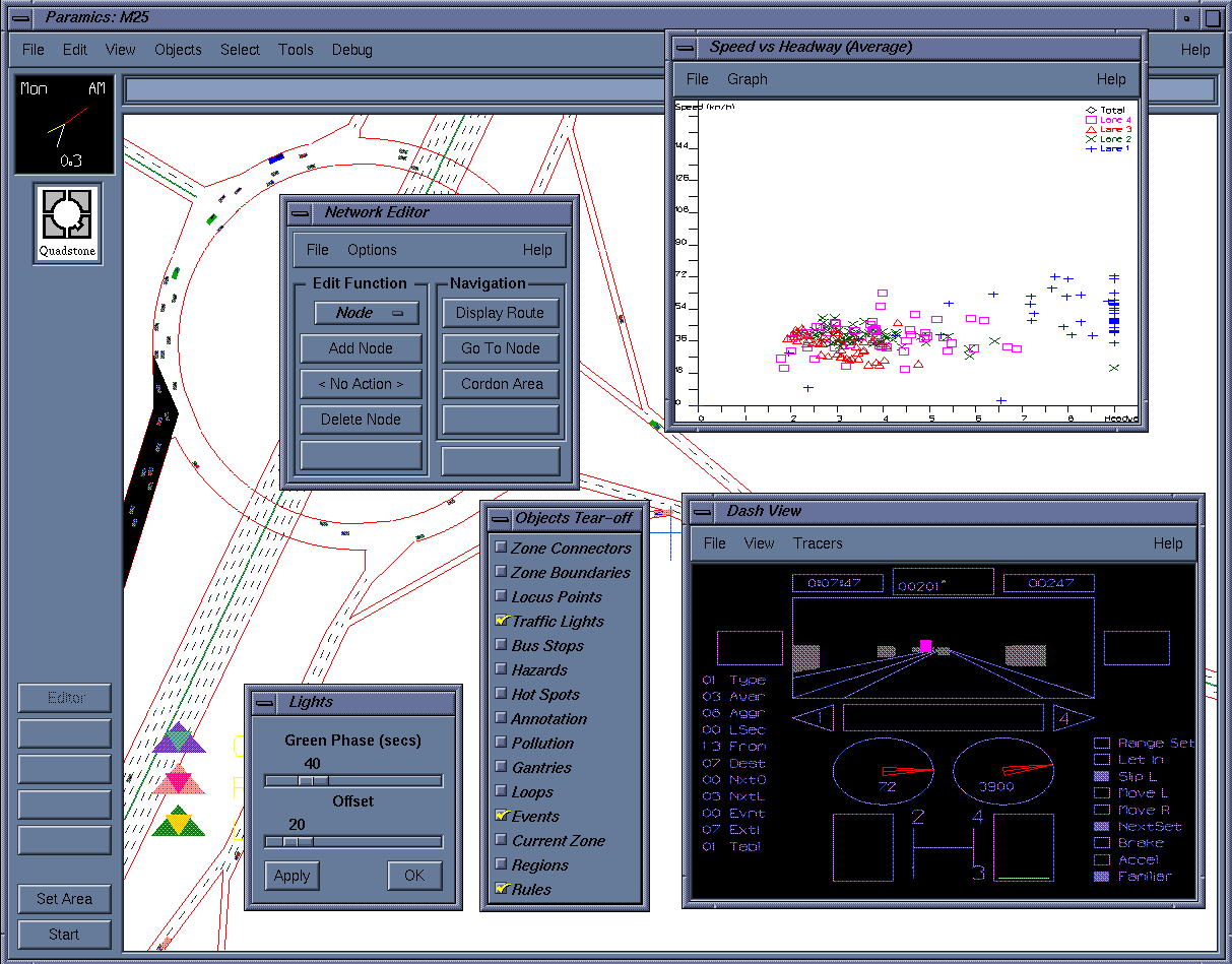
The Paramics User Interface
Limitations
Currently only runs on UNIX computers. A Windows NT/95 version will be produced before the
end of 1997.
Validation and Calibration
The Paramics model has been validated against a number of UK datasets. These include
validation against headway distributions, average speeds, lane usage and lane change rates on UK
motorways. In the urban environment comparisons have been made against the outputs from the
Arcady and Picardy programs and against standard formulae for saturation flows at traffic signal
controlled junctions.
Contact/Distribution Details
|
Paramics was developed, is used for worldwide consultancy and is distributed and supported
in the UK and Ireland by:
SIAS Ltd
37 Manor Place
Edinburgh
EH3 7EB
Telephone: +44-131-225-7900
Fax: +44-131-225-9229
E-Mail: lucy.richardson@sias.com
WWW: http://www.sias.co.uk/
Users should contact SIAS for the current prices.
|
Paramics is distributed and supported in the rest of the world (i.e. excluding UK and Ireland) by:
Quadstone Ltd
16 Chester Street
Edinburgh
EH3 7RA
Telephone: +44-131-220-4491
Fax: +44-131-220-4492
E-Mail: paramics-info@quadstone.com
WWW: http://www.paramics-online.com/
Users should contact Quadstone for the current prices.
|
Bibliography
Cameron GDB and Duncan GID (1996) PARAMICS, parallel microscopic simulation of road
traffic. Journal of supercomputing. Vol. 10, no. 1, pp. 25-53.
Duncan GI (1995) PARAMICS Wide Area Microscopic Simulation Of ATT And Traffic
Management. Proceedings Of The 28th International Symposium on Automotive Technology and
Automation (ISATA) Held 18th-22nd September 1995 In Stuttgart, Germany. 1995. pp. 475-84.
Duncan G (1996) Simulation At The Microscopic Level, Traffic Technology International.
1996/02/03. pp62-3,65-6, UK & International Press, 120 South Street, Dorking, Surrey, RH4,UK
McArthur D (1995) The Paramics-CM (Parallel Microscopic Traffic Simulator For Congestion
Management) Behavioural Model, Transportation Planning Methods. Proceedings Of Seminar E
Held At The 23rd European Transport Forum, University Of Warwick, England, September 11-
15, 1995. Volume P392. 1995. pp. 219-31.
Smith M, Duncan G and Druitt-S (1995) PARAMICS: Microscopic Traffic Simulation For
Congestion Management. Dynamic Control Of Strategic Inter-Urban Road Networks. Institution
of Electrical Engineers, London.
Objective
The primary objective of PHAROS (Public Highway And ROad Simulator) was to provide a
detailed roadway environment for a simulated robot driving vehicle. The simulated environment
was to be used not only for developing driving logic for the robot, but for studying actively
controlled visual search; thus geometric aspects of the environment were important. The type and
location of signs, signals, markings, and vehicles is represented in detail to allow the program to
determine where (angles) the visual system of the robot needs to look while driving. The robot's
driving program can send "visual queries" to PHAROS, assess the road and traffic situation, and
send further queries until it knows what to do. It then sends steering and acceleration outputs to
PHAROS.
Application field
PHAROS as it stands now is primarily useful for researchers interested in having or developing a
traffic environment for intelligent agent research. Note however that since the source code is
available, it is written in plain C, and it even has some decent structure to it, it would be easily
possible for a programmer to extend it to include new functions.
Technical approach
PHAROS is a microscopic traffic simulator in which each vehicle continually views the situation
and makes its own decision about acceleration and lane choice. For both of these decisions, the
PHAROS drivers choose the most preferred value given a set of constraints. Acceleration is
constrained by several factors: the speed of the car in front, the legal speed limit of the road, the
physical speed limit of the road (i.e. from curvature), and the possible requirement to stop at an
intersection ahead. There may be more than one of some of these constraints (e.g. several visible
intersections). If the driver is changing lanes, these constraints in the other lane also apply. In
each case the constraint speed and the distance to the constraint point, along with the desired or
maximum braking value, the driver response time and dt, determine the maximum allowed
acceleration. The maximum allowed is taken to be the preferred acceleration. Lane choice
constraints are based on the desired manoeuvre at a nearby downstream intersection vs. the
manoeuvres allowed from the lane, long queues formed from downstream intersections, lane
lines, and the presence of a traffic gap in a lane. Lane choice preferences include a default
preference for moving to the right lane, a preference to be in the correct lane for the manoeuvre
at a distant downstream intersections, and a preference for an adjacent lane that allows higher
acceleration. If the most preferred allowable lane is not the driver's current lane, it will initiate a
lane change manoeuvre which takes several seconds to complete. During that time the driver is
subject to acceleration constraints from both lanes. When determining whether to stop at an
intersection, PHAROS drivers first consider traffic control. There are four equivalence classes of
traffic control. In decreasing priority, they are: 1, green signal, yellow signal if robot has already
stopped at the intersection or cannot stop, or no control; 2, yield sign or no control on a minor
road intersecting a major road; 3, stop sign, or a red signal if turning right, stopped, and right
turns are allowed on red; and 4, red signal or yellow if the robot has not yet stopped and can stop.
If there is conflicting traffic at the intersection, the drive considers its distance from the
intersection and its traffic control. If the cars conflict and the traffic control classes are the same,
then the driver considers "deadlock" resolution schemes based on road configuration, order of
arrival, opportunity, and driver aggressiveness.
Innovation
- Representation of type and location of all signs, signals, and markings
- Computation of continuous position and orientation of each car, even while traversing an
intersection or changing lanes.
- Single acceleration control (and hence headway control) behaviour mechanism for free flow
and queued conditions resulting in seamless transitions between these conditions.
- Driver control behaviour independent of time step size (which is settable with recompilation),
default step size 100 ms.
- Explicit model of driver delay in moving between braking and acceleration.
- Brake light and turn signal indications on cars.
- Random driver aggressiveness parameter that affects desired free flow speed, headway,
priority at deadlocked intersections, reaction time, and merging behaviour.
- Ability of drivers to merge into a queue of cars.
- Modelling of uncontrolled intersections and uncontrolled minor roads (e.g. driveways
entering main roads).
- Comprehensive intersection logic that considers conflicting vehicles unable to stop,
conflicting vehicles too far away, yield and stop signs, signals, minor and major roads, order
of arrival, and driver "aggressiveness."
- Lane selection logic that considers speed constraints in the current and adjacent lanes, future
turn manoeuvres, distance to the downstream intersection, gaps, and long queues.
- One vehicle in the simulation can be driven by a separate program that communicates
(queries for visible objects in specified ways and provides lane choice and acceleration
commands) with PHAROS. The separate driving program can run on a different computer
and communicate via a network connection.
State of development
PHAROS is a research program. It does not have a nice input interface for traffic networks. It
would require (but allow) user modification to incorporate new traffic behaviour and
measurement functions. It was written to work under SunView on a Sun workstation; it could
also be ported to X Windows or a PC platform.
Useful technical features
Network size. Increasing the number of vehicles only slows the simulation down; otherwise there
is effectively no limit (well, maybe 2^32 vehicles). Speed has not been benchmarked on current
processors, but on an old Sun 2 workstation it could run on the order of 100 cars in real time.
There is effectively no limit on network size.
Network details. Network: represented as intersections with "links" between them. Links are
divided into segments which are uniform throughout the segment. Segments can have any
number of lanes, including lanes that start (or end) by changing width from 0 to the lane width
(or vice versa). Lanes can be any width. Lanes can be marked on the left and right by lines of
various types. There may be markings (e.g. turn arrows) in the lanes. Segment edges can have
shoulder lanes, and can have special markings such as diagonal stripes. Curved segments are
defined by cubic splines so that they smoothly mate with adjacent straight segments. Segments
can have defined speed limits (i.e. indicating safe driving limits due to curvature). Signs of any
standard type can be located along the segment or above lanes. Intersections are defined
geometrically by the cubic spline paths that connect the end of one link with the beginning of
another. Intersections can have signals or Stop/Yield signs at them. Signal heads can be in several
predefined locations above or across the intersection or before it. The user can specify the
number, colour, size, and symbol of lenses on each signal head. Stop lines and crosswalks may be
defined on any approach. Each approach to an intersection can connect to up to five downstream
links, thus allowing for fairly complicated intersections. Traffic movements are defined by
having the user provide a percentage for each movement at each intersection.
Vehicle representation. Currently all vehicles use the same decision logic and same physical
parameters; these correspond to a passenger car.
Vehicle assignment. Not available.
Control strategies and algorithms
There are no route navigation systems modelled in PHAROS.
User interface
The network must be described by the user in a text file. This is admittedly cumbersome and
requires pre-calculation of the x, y locations of all segments. The output of the simulator is an
animated colour graphical display showing a bird's eye view of the road network and the cars.
The display can be panned and zoomed. The animation can be paused, single stepped and
restarted. Traces of vehicle decisions can be displayed while running. There are no traffic
measurements or statistics generated.
Limitations
In addition to the limitations mentioned in various sections above: Overtaking was not
implemented. There are of course any number of limitations that fall in the category, "not a
perfect simulation of human behaviour." This is an open ended research problem.
Validation and Calibration
None.
Contact/Distribution Details
Available from the designer for free (well, for acknowledgement).
Dr. Douglas A. Reece
Institute for Simulation and Training
3280 Progress Dr.
Orlando, FL 32826
USA
E-Mail: dreece@ist.ucf.edu
Bibliography
Reece, D. and Shafer, S. (1995) Control of Perceptual Attention in Robot Driving. Journal of
Artificial Intelligence, Vol. 78 No. 1-2.
Reece, D. and Shafer, S. (1993) A Computational Model of Driving for Autonomous Vehicles.
Transportation Research, Vol. 27A No. 1, pp. 23-50.
Reece, D. (1992) Selective Perception for Robot Driving. CMU-CS-92-139, Department of
Computer Science, Carnegie Mellon University
Reece, D. and Shafer, S. (1988) An Overview of the PHAROS Traffic Simulator. In J. A.
Rothengatter and R. A. deBruin, editors, Road User Behaviour: Theory and Practice. Van
Gorcum, Assen, The Netherlands.
Objective
The program implements a number of microscopic models. Microscopic means: any car has in
principle an individual set of parameters, such as maximum velocity, acceleration abilities and,
most important for performing network simulations, an individual route-plan that determines its
route through the network. The simulator serves mainly two aims: (1) we use it to investigate
different microscopic traffic flow models in their “natural environment” in order to learn how
different models describe traffic. Up to now, we have implemented a number of different
microscopic models of traffic flow which can all coexist with each other within one network,
however they are all members of a family that we call “minimal” models. They differ from most
microscopic models we are aware off in the fact, that only a small set of assumptions about
human driving behaviour is used, we never try to simulate detailed driving behaviour. (2) The
second reason for the development of this simulation program has been the ability of those
minimal models to perform very fast simulations of considerably large networks, which make
them an ideal candidate to change the static assignment usually used in traffic planning into a
truly dynamic one. At least for medium-sized networks, and for problems related to the advent of
ITS and Telematics, they are the ideal instrument to compute the effects of those new control
techniques before actually introducing them into reality.
Application field
The simulation tool is aimed at testing different strategies especially in traffic system
management and in transportation planning. However it seems reasonable to use it for doing on-
line control of traffic also, however we have to develop the microscopic models in more detail
and test them with more realistic data until that can be done with success. This work is currently
in progress. Note, that the simulation tool is still in rapid development, so that we are able to
react upon new problems and challenges.
Technical approach
The simulation program is written in C++ and allows for the simulation of arbitrary road
networks. The program builds its internal representation of the network from the description
given in a file. An additional program that is able to convert a number of external file-formats
into the format used by PLANSIM-T exists. Additionally the program has a, however somewhat
limited, graphical interface, which is currently used for testing purposes.
Innovation
There are two main features: (1) the program implements a family of real fast microscopic
simulation models with various levels of reality. It enables to couple these models with each
other, and we are currently looking for the possibility of coupling other simulation models with
our model. This is interesting in situations, where one wants a re very detailed microscopic
simulation (the other program) within the context of a larger network (our program). (2) Because
of its large numerical efficiency, (which can be increased even further by a parallel version of the
program) the model allows for a dynamic assignment. The corresponding algorithms are already
built-in, but are not yet fully tested.
State of development
It is still a research product.
Useful technical features
Network size. Depends only on the size of your memory and on the computing power available.
We have simulated the German highway network with 1 Million cars and 3000 nodes. The main
limitation comes from the storage of the route-plans, which very quickly reach large amounts of
memory.
Network details. As mentioned above, we do not intend to do a detailed microscopic simulation.
While the network is resolved into full details (if available), e.g. number of lanes, topography,
transfer and turning lanes, traffic lights, the micro-simulation details are limited to a rough
approximation of the velocities and accelerations and driving patterns found in reality, although
the model calculates the velocity and position of any car for any second. It seems however a good
idea to use only aggregated observables in order to avoid all the peculiarities connected with a
microscopic modelling
Vehicle representation. Up to now, we are restricted to motorised vehicles, and we have a
restriction when it goes to calculate the emissions caused by cars. But this is only a problem of
the non-availability of those data, and not a problem of the microscopic simulation.
Vehicle assignment. It is possible to specify vehicle classes and their respective ratios in the
traffic flow. Each vehicle class (again their number is virtually unlimited) is characterised by the
parameters of the corresponding microscopic model used. For the most realistic model of the
family this is the acceleration, the maximum speed, the maximum deceleration, the length of the
vehicle and a parameter describing the acceleration noise.
Control strategies and algorithms
Internal: simulation code (microscopic model), parallelization of the simulation code, routing
algorithms (Dijkstra).
User interface
Interface is mainly through text files, however a limited GUI exists that presents the current state
of the network by colouring the links according to density, velocity, or by showing single cars on
any link.
Limitations
Microscopic modelling is not correct, only aggregated variables come out in the right way.
However, macroscopic flow characteristics are very well reproduced. Currently, there are
problems with the dynamic assignment, which tends to oscillations under fully congested
conditions.
Validation and Calibration
Currently, we are going to calibrate the microscopic modelling in more detail. A preliminary
calibration exists already and has been the reason to improve the microscopic details of the
model in use. The second part, the dynamic assignment will be subject to testing with real data
during this year (1997). This is to be done in the frame-work of the so called research co-
operative traffic simulation and environmental impact (FVU), situated in Northrhine Westfalia,
Germany, where a number of universities are doing interdisciplinary work.
Contact/Distribution Details
Currently, we are not intending to distribute this program. It would be great, if the results we
have achieved, can be used in other programs. Virtually any of our results are published and are
therefore open for test, critique and request.
The program has been developed mainly by Christian Gawron (eMail: gawron@zpr.uni-koeln.de,
phone: (221)470-6026 and Peter Oertel (oertel@zpr.uni-koeln.de), with substantial input by
Stefan Krauß (eMail: stefan.krauss@dlr.de, phone: (2203)601-2864) and Peter Wagner (eMail:
peter.wagner@dlr.de, phone (2203) 601-2853). All persons are currently with the ZPR (Centre of
Parallel Computing), and with the DLR (German Aerospace Research Establishment). The
addresses are, respectively: ZPR, Weyertal 80, D-50931 Koeln, and DLR, Porz-Wahnheide,
Linder Hoehe, D-51147 Koeln.
Further information can be found on the home-page of the traffic group of the ZPR, at:
http://www.zpr.uni-koeln.de/GroupBachem/VERKEHR.PG/
Bibliography
Krauss, Wagner and Gawron, (1996) Continuous version of the Nagel Schreckenberg CA, Phys.
Rev. E 24, 193
Krauss, Wagner and Gawron, (1997) Phys. Rev. E, to be published.
Nagel, Ph.D.-thesis, available from ZPR-WWW-server
Nagel K and Schreckenberg M, (1992) A cellular automaton model for freeway traffic, J. Phys. I
France, 2, 2221.
Rickert M, Nagel K, Schreckenberg M and Latour A (1996) Two lane traffic simulations using
cellular automata, Physica A, 231, 534.
Wagner P, Nagel K and Wolf DE (1997) Realistic multi-lane traffic rules for cellular automata,
Physica A, 234, 687.
Objective
SHIVA (Simulated Highways for Intelligent Vehicle Algorithms) is designed to model the
tactical-level of driving, and to make it easy to design and test intelligent vehicle algorithms that
operate at this level. SHIVA's modular, object-oriented structure allows easy extension.
Application field
SHIVA is primarily aimed at the intelligent vehicle research community (research lab or
academia). SHIVA is designed to help people write AI programs that drive vehicles in traffic.
Technical approach
2-D kinematically accurate vehicles driving on user-defined highway. Microscopic (0.1 sec)
time-steps, with every vehicle on the track performing a sense-think-act loop. Controllers are
compatible with Carnegie Mellon Navlab robot controllers. Sensor models are fairly realistic.
Innovation
- Simulation and design tool for developing intelligent vehicles.
- Provides substantial support for tactical-level algorithm development.
State of development
A research tool. SHIVA has not yet been released outside CMU.
Useful technical features
Network size. Currently, SHIVA's run time is N^2 with vehicles because tactical-level scenarios
typically involve small numbers of vehicles (no more than 20). SHIVA can comfortably simulate
~50 vehicles on an SGI workstation, with all graphics enabled.
Network details. Roads consist of lanes (or arbitrary shape). Since SHIVA is restricted to
modelling highways, no intersections (or traffic signals) are modelled. SHIVA is 2-D, so this
limits highway topologies. Vehicles are not constrained to remain in a single lane -- they may
straddle lanes, run off the road etc.
Vehicle representation. All vehicles are kinematically equivalent, with different parameters. The
emphasis is on vehicle *algorithms* -- how the vehicles drive. SHIVA's open-ended architecture
allows new sensors and controllers to be developed easily in the framework.
Vehicle assignment. Vehicles are created by "Factories" in user-specified locations.
Control strategies and algorithms
SHIVA supports heterogeneous vehicle control algorithms. Different cars are equipped with
different sensors (lane trackers, vehicle trackers etc.) and may use different algorithms to drive.
Currently, SHIVA provides both a rule-based monolithic architecture, as a distributed multi-
agent architecture incorporating learning.
User interface
SHIVA can be run without graphics on any UNIX system. Interactive 3-D graphics are available
on SGI workstations. These are customisable according to user needs.
Limitations
2-D world model. Does not scale for huge highway networks. Cannot model city roads. No
pedestrians, cycles etc. Not designed for large numbers of vehicles.
Validation and Calibration
SHIVA is used to design intelligent vehicles that do not, as yet exist in real-life. No validation
has been performed.
Contact/Distribution Details
SHIVA is currently not being distributed.
For further details contact:
Dr. Rahul Sukthankar
Robotics Institute
Carnegie Mellon University
Pittsburgh PA 15213
USA
E-Mail: rahuls@ri.cmu.edu
WWW: http://www.cs.cmu.edu/~rahuls/shiva.html
Bibliography
Sukthankar, R, Pomerleau, D. and Thorpe, C. (1995) SHIVA: Simulated Highways for Intelligent
Vehicle Algorithms, Proceedings of IEEE Intelligent Vehicles".
Sukthankar, R., Hancock, J., Pomerleau, D. and Thorpe, C. (1996) A Simulation and Design
System for Tactical Driving Algorithms, Proceedings of AI, Simulation and Planning in High
Autonomy Systems.
Sukthankar, R. (1997) Situation Awareness for Tactical Driving, Thesis, Carnegie Mellon
University, January1997, Also available as CMU Tech Report CMU-RI-TR-97-08."
Sukthankar, R., Hancock, J. and Thorpe, C. (1997) Tactical-level Simulation for Intelligent
Transportation Systems, To appear in Journal on Mathematical and Computer Modelling, Special
Issue on ITS
Objective
To simulate traffic behaviour within a network of signal controlled junctions for the evaluation of
signal control policies.
Application field
Evaluation of signal control strategies. Aimed at universities.
Technical approach
Individual vehicles are simulated using a car-following model developed by Gipps which
calculates the speed and position of each vehicle on a lane according to each vehicle's individual
characteristics and the characteristics of the vehicle in front. Vehicles are updated at regular
intervals. The simulation is event based and vehicle update is one of a number of events that can
take place.
Innovation
- Various signal control strategies
- Combination of event-based and time-based simulation
- Detailed detector modelling
State of development
Research with on-going development.
Two separate versions with a common origin:
1. Parallel (runs on Transputers) - Centre for Transport Studies, UCL
2. Sequential (Unix base) -TORG, Newcastle
Useful technical features
Network size. The size of the network and the number of vehicles is limited by the available
memory. For the parallel version 4 nodes (junctions) is optimum; the largest network simulated
to date is 10 nodes with an anticipated maximum, in its current hardware environment, of about
30 nodes.
Network details. A network is modelled in terms of lanes, links & junctions (nodes). Traffic
movement is along routes specified by links with vehicles selecting lanes on links, when moving
between links, depending upon their destination.
Vehicle representation. Cars, heavy goods vehicles, light goods vehicles, buses, motorcycles.
Other types (or subtypes) can be easily added.
Vehicle assignment. There is no modelling of route choice in this simulation.
Control strategies and algorithms
Signal control strategies included:
- Fixed time
- System D (with and without bus priority)
- TORG Control (with and without bus priority)
- SCOOT like (TORG serial version)
External signal control:
- SCOOT (CTS parallel version)
User interface
Text files for initialisation data and statistical output data.
Graphical display of network (concurrent with simulation or/and post run)
Limitations
Size of network and speed of operation. The latter, particularly in the serial version, is dependent
on the size of the network. An increase in size under the parallel version has a relatively marginal
effect.
Contact/Distribution Details
Distributed by: TORG, University of Newcastle, Newcastle-upon-Tyne, NE1 7RU, UK.
For further technical details contact:
David Crosta
Centre for Transport Studies
UCL
Gower St
London
WC1E 6BT
UK
Telephone +44-171-391-1574, Fax: +44-171-391-1567, E-Mail: davec@transport.ucl.ac.uk
Bibliography
Crosta, D.A. (1994a) Parallelisation of SIGSIM : 4 junction model, Working Paper, University of
London Centre for Transport Studies.
Crosta, D.A. (1994b) Parallelisation of SIGSIM : Multiplexed networks, Working Paper,
University of London Centre for Transport Studies.
Crosta, D.A. (1997) Parallel SIGSIM User Guide, Working Paper, University of London Centre
for Transport Studies.
Law, M. (1997a) SIGSIM User Guide: Part A SIGSIM Theory Working Paper, TORG,
University of Newcastle.
Law, M. (1997b) SIGSIM user Guide: Part B Serial SIGSIM User Guide, Working Paper,
TORG, University of Newcastle.
Silcock, P.J. (1993) SIGSIM Version 1.0 User Guide Working Paper, University of London
Centre for Transport Studies.
Objective
SIMDAC is a microscopic traffic simulation tool with detailed driver behaviour modelling,
meant to reproduce the evolution of a line of cars on a single lane, and to evaluate the safety and
comfort condition (in term of headways, time-to-collision, acceleration noise) for various
disturbing manoeuvres of the leading car.
Application field
This simulator was designed to assess the efficiency of various devices meant to decrease the risk
of rear-end collision (reinforcement or new design of brake lamp configurations). This tools is a
research tool, which was developed in the frame of a study funded by the French Ministry of
Transport, in order to extrapolate the identified behaviour of two equipped cars to a line of
vehicles.
Technical approach
The simulation uses a more detailed model than usual microscopic traffic flow simulators : it
includes a driver model (which takes into account foot placement on the pedals and vigilance
level), and two separate car-following laws, in order to better represent the dissymmetrical
behaviour between acceleration and braking phases. A short integration time step (0.05 s.)
enables to take into account a random distribution of drivers reaction times.
Innovation
- Detailed driver behaviour (foot placement, vigilance level)
- Possibility to simulate a realistic reaction time dispersion among drivers
- Detailed dynamic display of vehicles and drivers behaviour
State of development
Research product.
Useful technical features
Network size: 1 single lane
Network details: see above
Vehicle representation: 1 type of vehicle, but realistic description of drivers, characteristics
dispersion.
Vehicle assignment: No assignment
User interface
- dynamic visualisation showing the variation of relative functions of vehicles and of the drivers
state
- graphical interface for parameters analysis at the end of a run (headways, collision time, ...)
Limitations
No lane changing model
Validation and Calibration
Real-life experiments involving two equipped cars enabled to calibrate :
- maximum deceleration
- mean values of drivers reaction times with respect to the tested devices.
Designer
Jean-François GABARD
ONERA-CERT
2 avenue Edouard Belin
BP 4025
31055 Toulouse Cedex - France
Telephone: +33-562-25-27-70, Fax: +33-562-25-25-64, E-Mail: gabard@cert.fr
Bibliography
Gabard J.F., Henry J.J., (1990) SIMDAC : A Simulation Tool for Testing Anti-Collision Devices
PROMETHEUS Proceedings of the 3rd Workshop, Torino, pp 629-638, April 1990
Objective
The objective of the simulation model SIMNET is the evaluation of traffic control measures
based on individual vehicle simulation.
Application field
SIMNET has been developed as an internal research tool within the TU Berlin. The main
purpose is to evaluate traffic control strategies, ranging from AICC at the vehicle level up to
DRG at the network level.
Technical approach
SIMNET is mainly a discrete event simulation, where the traffic model is a queuing model. In
1986, SIMNET has been extended with a quasi continuous vehicle model based on car following
theory. Both models can be used together in the same simulation.
Innovation
Combination of discrete event simulation and quasi continuous simulation, individual random
number streams for each simulated process.
State of development
Research tool
Useful technical features
Network size : there are only a few software limits in SIMNET :
theoretical limit (software) , 65535 vehicles, 4095 links, max. three day simulation time
largest simulation, 10 000 vehicles, 600 links, one day
Network details : SIMNET does always individual vehicle simulation, the vehicle's positions are
defined as queue-positions on a lane in the queuing model and as real position (resolution 1 cm)
on a lane in the quasi continuous model.
Vehicle representation : there is a direct simulation of Passenger cars, lorries, coaches and buses,
pedestrians are considered as additional delay on right turns.
Vehicle assignment : a given percentage of vehicles can follow predefined routes. The other
vehicles follow random routes according to turning proportions.
Control strategies and algorithms
There are several strategies and algorithms included AICC, several intersection control algorithms,
Tidal Flow Systems, VMS-based Parking Guidance and Route Guidance, DRG based on infra-red
beacons.
User interface
ASCII - Text files + little graphic (needs IBM-PHIGS) + plots of results (MPGL)
Limitations
Tram simulation is missing, public transport signalization needs some development, import and
export filters for simulation input- and output-conversion into commercial date bases etc. could
be useful.
Validation and Calibration
The queuing model has been validated by comparison of travel times through links, arterial roads
and through the network with measured travel times, and also by comparison of speed
distributions. The quasi continuous movement model has been validated by comparison of
simulated time headway distributions with measured ones.
Documentation user's guide
There is not up-to-date documentation available.
Distribution
As SIMNET is an internal research tool, there is no distribution.
Designer
SIMNET has been developed at the TU Berlin. FG Strassenplanung und Strassenverkherstechnik
by Dr. Ing. K. Leichter (1975-1982), Dipl. Ing. W. Schober (1977-1992), Dipl.-Ing. M. Glatz
(1989-1995)
Bibliography
CAR-GOES (1991) DRIVE V1011 - Integration of Dynamic Route Guidance and Traffic Control
Systems, Deliverable 13/15 : Final report on High Penetration Route Recommendations, Results
of Simulations, and Implications for System Architectures (not published)
Schober W., Glatz M. (1995) The road traffic simulation model SIMNET and its application to
dynamic route guidance simulation; Proceedings of the 6th International Conference on
Computing in Civil and Building Engineering, Berlin 12-15 July 1995; A.A. Balkema, Rotterdam
1995.
Objective
SISTM (SImulation of Strategies for Traffic on Motorways) has been designed to study
motorway traffic in congested conditions with the aim of developing and evaluating different
strategies for reducing congestion.
Application field
SISTM can assess
- different motorway layouts (i.e. junction designs)
- variable speed limit systems
- ramp metering systems
- modified vehicle characteristics
- modified driver behaviour
It has been developed for the UK Highways Agency but could be used for any body requiring
modelling of motorways.
Technical approach
It is a microscopic motorway simulation with a car following algorithm that uses a modified
Gipps' equation. Driver behaviour is described by 2 parameters; aggressiveness and awareness,
and these are used to produce distributions of desired speed and indirectly desired headway. The
time increment used is 5/8th second. Lane changing is controlled through a lane changing
stimulus with the user specifying the desire to change lanes.
Innovation
When making a lane changing manoeuvre, a driver is allowed to accept an "unsafe" headway
temporarily. This is to allow smooth merging to take place when a driver has to move into a
particular lane.
State of development
Not sold commercially. Only available for TRL or Highway Agency. Development started in
1988. Version 4.3 is the latest version and includes a Windows executable. Version 5 scheduled
for early 98 will include modelling of the all purpose road network surrounding a motorway.
Useful technical features
Network size. 99 km of uni-directional motorway with 9 entry and 9 exit slip roads. 4000
vehicles being modelled at any instant.
Network details. Motorway geometry to an accuracy of 1 metre. Ghost islands at merges can be
modelled. Gradients can be modelled, but bends cannot. Narrow lanes cannot be modelled. Up to
6 main carriageway lanes and 3 slip road lanes.
Vehicle representation. Up to 8 vehicle types, with different lengths, desired speed, distributions
for drivers' acceleration and braking rates.
Vehicle assignment. No route assignment. User must supply an O/D matrix which specifies the
flows from each entry slip road to each exit slip road.
Control strategies and algorithms
VMS, Variable speed limits and ramp metering are all internal to the model.
User interface
The user can choose to edit text files or use specially written data entry programs.
Graphical representation of vehicles as they are being modelled.
Limitations
Cannot model complex motorway merges and diverges.
Cannot model link/connector road systems yet.
Validation and Calibration
Has been validated against average speeds and flows at specific points, using detector loops, on a
section of a 3/4 lane motorway.
Contact/Distribution Details
Not distributed.
For further information contact:
Ewan J Hardman
Transport Research Laboratory
Crowthorne
Berks
RG45 6AU
UK
E-Mail: Mr.E.J.Hardman@T.trl.co.uk
Bibliography
Harbord B (1995) The Application of SISTM to Dynamic Control of the M25. Dynamic Control
Of Strategic Inter-Urban Road Networks, Institution of Electrical Engineers, London.
Hardman EJ (1996) Motorway Speed Control Strategies Using SISTM. Proceedings of the Eighth
International Conference on Road Traffic Monitoring and Control, 23-25 April 1996. Conference
Publication No. 422. pp. 169-72, Institution of Electrical Engineers, Savoy Place, London, United
Kingdom.
Harwood NW (1993) An Assessment Of Ramp Metering Strategies Using SISTM, TRL Project
Report PR 36, Transport Research Laboratory, Old Wokingham Road, Crowthorne, Berkshire,
RG11 6AU, United Kingdom.
Objective
The objective of SITRA-B+ is to represent as accurately as possible, the traffic of various types
of vehicles in a urban network, taking into account among others detailed intersection layouts
and different kinds of detectors, and therefore to provide the user with an assessment tool, able to
compare in an objective way different UTC or guidance strategies.
Application field
- Assessment of Urban Traffic Control and guidance strategies, including public transport
policies, parking management
- Test of network layouts
- Organisation: research centres, universities, city authorities, route guidance operators, traffic
signalling companies, public transport operators
Technical approach
- Car-following law derived from the Helly model, 1 s. integration time step
- Lane changing strategy
- Internal movements within complex intersections described by internal lanes and conflict
management
- Dynamic memory allocation for vehicles management
Innovation
- Use of an object-oriented programming language
- Strategies to be tested considered as a separate process (synchronisation protocol for data
exchanges)
- User-friendly visualisation interface (monitoring and checking during a run)
- User-defined vehicle types
State of development
Research product.
Distributed to some partners in DRIVE projects.
Useful technical features
Network size. No a priori limitation (use of dynamic memory allocation). Usual network size : up
to 30 intersections, 80 links, 4000 vehicles.
Network details. Links : several lanes, lateral parking lots, reserved lanes, bus stops. Intersections
: movements inside (complex) intersection described by internal lanes, connection points,
forbidden movements, conflict management procedures. Local detectors (loops) of wide range
detectors/beacons (guidance).
Vehicle representation. Any type of vehicle (user defined). Choice of geometrical and
kinematics parameters. Choice of on-board equipment for road guidance strategies. Possible to
attach a schedule to the vehicle (Public Transportation, "scheduled vehicles").
Vehicle assignment. The demand is described by Origin-Destination matrices and an initial
assignment (1 set of possible paths for a given OD couple with associated assignment
percentage). An internal parametered assignment algorithm can be used.
Control strategies and algorithms
- UTC : fixed-time plans given by time slice : included other strategies (adaptive,...) : external
- Route Guidance : shortest path or travel time algorithm : included dynamic route guidance :
external.
User interface
- Data input : ASCII files
- Results analysis : ASCII files
- On-line visualisation: graphic display of the network and of the moving vehicles, with the
possibility of interrupting the run and to access vehicles', links' and detectors' parameters.
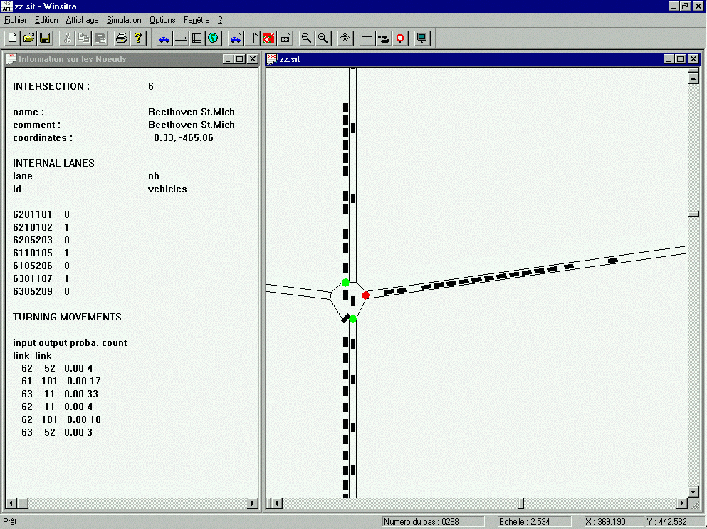
The on-line visualisation of the Windows NT version of SITRA-B+
Limitations
- Motorway traffic flow modelling, roundabouts modelling to be improved/added
- Extended validation needed
- Data input process to be improved (no user-friendly interface)
Validation and Calibration
- Car-following law was partially validated (travel times were checked on an 8 intersection
axis)
- Calibrated on a Lyon sub-network (LLAMD project)
- Some checking /validation of parameters / behaviours can be achieved through the
visualisation interface facilities
Documentation user's guide
"Manuel d'utilisation de SITRA-B+" Version 1.1. - January 1992 CERT Report n 042/92
Designer
Magali BARBIER (phone +33 5 62 25 27 61)
Jean-Loup FARGES (phone +33 5 62 25 27 76)
Jean-François GABARD (phone +33 5 62 25 27 70)
Fax +33 5 62 25 25 64
ONERA-CERT
2 avenue Edouard Belin
BP 4025
31055 Toulouse Cedex - France
Bibliography
Omli R. Farges JL, DMRG Simulation : Specification for Microscopic Models, PROMETHEUS
DMRG Workshop, Toulouse, July 1992
Barceló J. Software Environments for Integrated RTI Simulation Systems, Proceedings of the
DRIVE Conference - Brussels, February 1991
LLAMD V2033 DRIVE project. Impact Analysis of Priorities to Public Transport Strategies.
Deliverable n 2404, June 1993.
LLAMD V2033 DRIVE project Interim Report on Distributed TCS/RG Strategy Deliverable
N 6006, March 1994
Henry JJ, PRO-GEN : Simulation - PROMETHEUS - September 1994, PROMETHEUS
PROGEN, "Assessment of 24 European Traffic Models", Volume 1 : Synthesis, Volume 2 :
Completed questionnaire, INRETS, December 1994
Objective
SITRAS aims to faithfully simulate the details of traffic flow on urban road networks with
emphasis on simulating congested conditions for the purpose of analysis and evaluation of
various intelligent transport systems, such as congestion and incident management systems and
route guidance.
Application field
SITRAS is a general and multi-purpose simulator. It simulates guided as well as unguided
vehicles and so may be used for analysing a variety of ITS applications and strategies. Simulation
of incidents of variable severity and duration enable the model to also be used for evaluation of
incident management strategies. It is intended to be a tool for urban road authorities.
Technical approach
SITRAS is a microscopic time-interval update simulation program implemented in an object-
oriented structure. The main modules of the model are vehicle progression based on car
following and lane changing theory, and route selection based on individual driver
characteristics. Fixed-time co-ordination and adaptive traffic signal control strategies can be
programmed into the network model. The driver-vehicle objects travel between their user-
defined origin and destination, selecting their route according to the prevailing traffic conditions
and to their individual route choice characteristics. Incidents of varying severity may be
programmed to occur at any point and time on the network and for any duration. The model also
allows the simulation of "guided vehicles" (i.e. vehicles fitted with an in-vehicle route guidance
device), enabling the evaluation of the effects of dynamic route guidance systems (DRGS).
Vehicle position and trip characteristics are constantly recorded during the simulation. The
average travel times recorded for every link are used to rebuild regularly the minimum paths
between each pair of origin-destination nodes. The model outputs provide various statistics of
vehicle and network performance.
Innovation
- Ability of vehicles to move between specific origin - destination points.
- Simulation of actual vehicle movements through intersections
- Extensive output on:
Network-wide, Link-wise and OD-wise MOEs,
Individual vehicle movements
State of development
The model has been developed as a purely research product until now. We seek and welcome
collaborative work from interested organisations. Although much progress has been made, the
model is still in development. Many features though currently absent from SITRAS, are planned
to be implemented in the model.
Useful technical features
Network size : no theoretical size limit has been set in the model. Practical size of the network
and number of vehicles simulated would depend on characteristics (available memory, etc.) of
the computer used. The model has only been used so far with small hypothetical networks, of the
order of 40 nodes and 80 links.
Network details : the network is represented as a graph of nodes connected by one-way links.
The model uses a three-level hierarchy of road links: arterial, collector and local links, to enable
the simulation of drivers' varying network knowledge. The link data includes geometric and
performance information, such as length, number of lanes, free-flow travel time and average
peak-flow travel time. To allow a realistic estimation of intersection delays, turning movements
are modelled in detail as a set of dummy links. Up to 6-leg intersections can be represented in
SITRAS.
Two types of signal control logic are currently implemented in the model: fixed time and vehicle
actuated signal control. For a fixed time signal the cycle time and all the phase green times are
set by the user, while at a vehicle actuated signal the user input includes the minimum and
maximum green and vehicle interval times for each phase. Vehicle detection on the approaches is
modelled by messages sent by each vehicle and recorded by the node control object from a given
distance, specifying the movement phase requested by the vehicle.
Vehicles are generated at their origin points according to a user-defined parabolic function
representing demand flow. These have varying vehicle type, driver type and driver network
knowledge as well as the ability to be assigned as guided or unguided vehicle. The vehicles then
progress over the network using car following and lane changing algorithms specially developed
for SITRAS.
Vehicle representation : vehicle types: car, truck, bus, transit vehicle.
The above types are further subdivided into Guided or Unguided sub-types.
Drivers of vehicles can display various levels of aggressiveness, which affects their reaction to
the driving environment. Also for route selection purposes, drivers are not necessarily familiar
with the whole network. Drivers may have the following levels of network knowledge:
- Local level (most familiarity with the network)
- Collector level
- Arterial level (least familiarity with the network)
Vehicle assignment
Drivers' route choice behaviour is dependent on whether or not their vehicle is assumed to be
fitted with an in-vehicle route guidance advice unit (guided/unguided vehicle). For unguided
vehicles, drivers' imperfect knowledge of the prevailing network conditions is modelled
according to Burrell's simulation method. This stochastic route choice method is combined in
SITRAS with the drivers' familiarity with the network, which is linked to a given level of
network hierarchy. If a driver's network knowledge is at the arterial level (the least familiar with
the network), the driver will select his perceived minimum cost route only from the sub-set of
alternative routes that he "sees", i.e. those consisting of arterial links only. If there is no such
alternative, they will then consider routes including lower level links. All guided vehicles are
provided with correct information about the prevailing minimum cost routes (updated by the
model in user specified intervals) and currently they all are assumed to follow the given route
advice. No attempt is made to predict future network conditions - therefore the model gives
unrealistic results if the guided vehicle population is more than 15-20 %.
Control strategies and algorithms
The following sub-models have been developed specifically for SITRAS:
- Car following
- Lane changing
- Route selection
- Route guidance
User interface
The program works in the 32 bit environment of Microsoft Window 95 utilising the inherent GUI
interface of the OS.
All input and output files of the program are saved in popular database file formats (both dBase
and Paradox) which may readily be used from a number of popular database and spreadsheet
software.
The simulation itself can be graphically animated (sample snapshot provided at the end of the
questionnaire) with vehicles identified using different colours based on their type, intended
turning movement at the next intersection, guided vs. unguided or a combination of these.
Output may be viewed on screen (tabular and graphic charts), printed or saved as simple text
files.
Limitations
Many features are yet to be implemented in SITRAS. The route guidance algorithm currently
assumes full compliance of drivers. This is to be addressed. Implementation of area-wide
adaptive traffic signal control systems requires attracting the collaboration of traffic authorities.
Our aim is to link SITRAS with the SCATS traffic signal control system developed by the Roads
and Traffic Authority of New South Wales.
Validation and Calibration
Calibration and validation of the model is the next step on the agenda in the development
process, currently in progress.
Documentation user's guide
None (except several conference papers, but not as user's guide)
Designer
Peter Hidas
University of New South Wales
School of Civil Engineering
Department of Transportation Engineering
Sydney NSW 2052 Australia
Kamran Behbahanizadeh
University of New South Wales
School of Civil Engineering
Department of Transportation Engineering
Email:p2124264@civeng.unsw.edu.au
Objective
Regional transportation simulation with the following design criteria: representation of each
individual vehicle; plan-following of each individual vehicle; realistic traffic dynamics on the
macroscopic scale; identification of driving dynamics on a microscopic scale possible; fast
computational speed (100000 vehicles in real time on coupled workstations, technology capable
of 5 millions vehicles in real time on supercomputer). Future: inclusion of other modes of
transportation.
Application field
Transportation planning questions, i.e. evaluation of different infrastructure changes such as
addition of lane, introduction of transit system, introduction of ITS technology, etc. Aimed at
transportation planning organisations. Note that TRANSIMS is a modelling suite, also including
modules for: synthetic populations and activity generation; modal choice and routing; analysis.
Technical approach
Driving logic: Simple car following and lane changing logic based on cellular automaton
technique (i.e. spatial resolution 7.5 meters). Signalised intersections modelled with signal plans.
Non-signalised intersections modelled with gap acceptance. Vehicles follow plans, i.e. lane
changing is biased in a way that vehicles are in correct lane at end of link. Parallel computing
possible.
Innovation
Coupling of (1) synthetic populations and activity generation, (2) modal choice and routing, (3)
micro-simulation, (4) analysis in one common framework.
Micro-simulation itself: Relatively extensive research about macroscopic behaviour of the
approach in the physics literature. Fast computational speed (100000 vehicles in real time on
coupled workstations, technology capable of 5 millions vehicles in real time on supercomputer).
Technology capable of regional scales (10 millions inhabitants or more).
State of development
Research product. Micro-simulation running and currently tested in example cases. Preliminary
versions of other TRANSIMS modules exists.
Useful technical features
Network size. No hard restriction but depends on size of parallel computer available. Current
Dallas/Fort Worth case study: ca. 10000 nodes, 15000 links, up to 50000 vehicles simultaneous
in simulation, runs on coupled workstations. Experimental version capable of running much
larger systems.
Network details. Lane connectivity, length of turn pockets, local streets, signal plans, protected
movements, etc. modelled.
Vehicle representation. Currently vehicles characterised by maximum speed only.
Vehicle assignment. Each traveller has a route plan which is pre-computed in the modal
choice/route planning module of TRANSIMS. We iterate between planner and micro-simulation,
i.e. route plans are changed based on link travel times from the micro-simulation.
Control strategies and algorithms
Not yet implemented.
User interface
Graphical interface for set-up of runs; graphical interface for representation of individual and
aggregated route plans; graphical interface for micro-simulation results. Network input via
arcview/oracle. Vehicle route plans currently via computer-generated ASCII files.
Limitations
Current model not suitable for questions whose resolution is smaller than 1 second or 7.5 meters.
Model is for transportation planning on a regional scale, not for, say, singular intersection design
outside a road network context.
Validation and Calibration
Traffic flow dynamics: Fundamental diagram, flows through signalised intersections, flow
through unsignalized intersections (stop sign, yield sign, unprotected left turns)
Validation of traffic in regional context under way
Contact/Distribution Details
Distribution planned for end of 1997 for research purposes.
For further details please contact:
Kai Nagel
Los Alamos National Laboratory
TSA-DO-SA, MS M997
Los Alamos NM 87545
USA
Telephone: +1 - 505 - 665 - 0921, Fax: +1 - 505-665-7464, E-Mail: kai@lanl.gov
Bibliography
Here is a list of publications. See also:
http://www-transims.tsasa.lanl.gov/
and
http://www-transims.tssa.lanl.gov/research_team/papers/
Barrett, CL, Wolinsky M and Olesen MW (1996) Emergent local control properties in particle
hopping traffic simulations (extended abstract), In: Traffic and Granular Flow, eds. D.E.Wolf,
M.Schreckenberg and A.Bachem, World Scientific, Singapore.
Nagel K (1996) Particle hopping models and traffic flow theory, Phys. Rev. E, 53(5), 4655.
Nagel K (1996) Fluid-dynamical vs. particle hopping models for traffic flow, In: Traffic and
Granular Flow, eds. D.E.Wolf, M.Schreckenberg and A.Bachem, World Scientific, Singapore.
Nagel, K (1997) Using micro-simulation feedback for trip adaptation for realistic traffic in
Dallas, International Journal of Modern Physics C (in press).
Nagel K and Schleicher A (1994) Microscopic traffic modelling on parallel high performance
computers, Parallel Computing, 20, 125-146.
Nagel K and Schreckenberg M, (1992) A cellular automaton model for freeway traffic, J. Phys. I
France, 2, 2221.
Nagel K and Schreckenberg M (1995) Traffic jam dynamics in stochastic cellular automata, In
Proceedings of the 28th International Symposium on Automotive Technology and Automation,
Automotive Automation Ltd, Croydon, England.
Paczuski M and Nagel K (1996) Self-organized criticality and 1/f noise in traffic, In: Traffic and
Granular Flow, eds. D.E.Wolf, M.Schreckenberg and A.Bachem, World Scientific, Singapore.
Rickert, M. and K. Nagel (1997) Experiences with a simplified micro-simulation for the
Dallas/Fort Worth area, International Journal of Modern Physics C, (in press).
Rickert M, Nagel K, Schreckenberg M and Latour A (1996) Two lane traffic simulations using
cellular automata, Physica A, 231, 534.
Schreckenberg M and Nagel K (1995) Physical modelling of traffic with stochastic cellular
automata, In Proceedings of the 28th International Symposium on Automotive Technology and
Automation, Automotive Automation Ltd, Croydon, England.
Smith L, Beckman R, Anson D Nagel K and Williams M (1995) TRANSIMS: TRansportation
ANalysis and SIMulation System, In Proc. 5th Nat. Transportation Planning Methods
Applications Conference, Seattle.
Wagner P, Nagel K and Wolf DE (1997) Realistic multi-lane traffic rules for cellular automata,
Physica A, 234, 687.
Objective
THOREAU was developed to quantify the benefits of Intelligent Transportation Systems,
primarily Advanced Traveller Information systems (ATIS) and Advanced Traffic Management
systems (ATMS). It does so by generating thousands of vehicles, simulating them on trips
through complex networks, and recording travel times. It is written in the MODSIN II.5 language
and it runs on UNIX workstations.
Application field
THOREAU has primarily been used for evaluation of various adaptive traffic signal algorithms,
from corridor synchronisation to real-time actuation to a combination of both. It has also been
used for evaluating the benefit of en route guidance based on reports from traffic probes and for
modelling diversion behaviour on a freeway belt way. It has been used primarily for the U.S.
Department of Transportation Federal Highway Administration, particularly the Joint Program
Office on Intelligent Transportation systems.
Technical approach
THOREAU is an object-oriented simulation written in the MODSIM II.5 language. Each signal,
detector, and vehicle is an object with its own schedule of events. THOREAU uses both the
microscopic and mesoscopic traffic modelling approaches to achieve speed and modularity and
to provide the desired performance statistics for individual vehicles, links, nodes, and trips. Both
microscopic and mesoscopic links can be mixed freely within a THOREAU model to achieve the
desired simulation speed and granularity. For microscopic simulation, vehicles moving along a
given lane on the current link are manoeuvred by actions defined by current position, speed,
driver type, maximum acceleration/deceleration rates, and available headway. Turns, lane
changes, and the merging of single-lane traffic from multiple source lanes at each intersection are
processed as required. For mesoscopic simulation, vehicles are moved from a link segment to its
neighbouring segment according to analytic speed-flow-density equations. Generally, the
mesoscopic logic models vehicle passage along links at a relatively coarse level of detail, but
considers in relatively fine detail interactions at the nodes and in gridlock or near-gridlock
situations.
Innovation
THOREAU uses models intersection right-of-way determination and incident-avoidance
manoeuvring as well as car-following logic. The route guidance and signal control algorithms are
modularised so that different algorithms may be substituted and evaluated. In particular, several
signal control algorithms have been studied and compared, including a new algorithm combining
corridor re-synchronisation and full actuation. Travel time statistics are reported for each vehicle
and aggregated by origin and destination, and by time of departure.
State of development
THOREAU is used primarily as an in-house research tool. It has been continually enhanced with
new and more realistic algorithms over the last five years. It is available at no charge to
universities. A license for use by a commercial company may be negotiated.
Useful technical features
Network size : the largest network currently modelled has approximately 200 nodes and 400
links. THOREAU could easily accommodate double or triple that number. The key constraint is
the number of concurrent vehicles. With 48 Mb of memory on Mitretek's workstation,
THOREAU can handle approximately 8,000 concurrent vehicles. There is no limit to the total
number of vehicles over the course of a simulation; we have run as many as 30,000.
Network details : each link is either meso or micro. Traffic along micro links is modelled in
detail; each vehicle's accelerations, lane-shifts, and other specific actions are explicitly modelled.
Traffic along meso links is modelled in the aggregate, with emphasis on computational speed.
Vehicle assignment : each vehicle generated is part of a stream of vehicles with a specified
origin and destination. All vehicles in this stream have the same specified path (sequence of
links) for moving from the origin to the destination. If the vehicle has route guidance, it may
change its path en route based on shortest path calculations. These calculations use travel times
reported by probe vehicles whenever they exit an link.
Control strategies and algorithms
- ATIS
- Fixed Signal Operation
- Dynamic Corridor Optimisation
- Actuated Signal Control
- The PICASSO Algorithm (Plan for Intelligent Control of Actuated Synchronised Signal
Operation to emphasise the fact that it combines both signal actuation and corridor
synchronisation)
User interface
The input files are all in ASCII format. There are input files for specifying nodes, links, traffic
signals, paths, vehicle arrival rates on each path, link capacities, and incidents. Output files are in
ASCII. There is also real-time interactive graphic output to the screen, with “zoom” capability
for selected nodes and attached links. Links and intersections are colour-coded to indicate level
of service. Detailed information on a vehicle or signal can be displayed by clicking on the
displayed object.
Limitations
Currently runs only on SUN workstations. Theoretically could be compiled and run on a PC, but
we haven't tried that yet.
Doesn't yet have explicit representation of transit or HOV.
Validation and Calibration
No official calibration or validation against real data has been performed, because comparable
data has not been available. Simulation results have matched very closely results from the
Integration 1.5 simulation (see reference 3).
Documentation user's guide
THOREAU documentation consists of a System Description describing all algorithms, objects,
methods, fields ,etc. and a User's Manual describing input and output files, how to run the model,
how to use graphics menu. Both are available from Richard Glassco, Mitretek Systems
(rglassco@mitretek.org).
Distribution
Contact Richard Glassco at Mitretek Systems. The executable module is available free to
universities. Arrangements with non-profit and commercial companies are made on a case-by-
case basis.
Designer
Original developer: Dr. William Niedringhaus, MITRE Corporation
Enhanced by Dr. Paul Wang, MITRE Corporation,
Further enhanced and maintained by Richard Glassco, Mitretek Systems
THOREAU (Traffic and Highway Objects for REsearch, Analysis, and Understanding)
contact: Richard A. Glassco or Michael F. McGurrin
Mitretek Systems
600 Maryland Ave. SE, Suite 755
Washington, DC 20024
Telephone +1-202 488-5713, E-Mail: rglassco@mitretek.org or mcgurrin@mitretek.org
Bibliography
The Traffic and Highway Objects of REsearch, Analysis, and Understating (THOREAU) Model,
Version 2.2, Volume 1 - System Description, March 1997, Mitretek Systems, Washington, DC.
The Traffic and Highway Objects of REsearch, Analysis, and Understating (THOREAU) Model,
Version 2.2, Volume 2 - User's Manual, March 1997, Mitretek Systems, Washington, DC.
Glassco, Proper, Salwin, and Wunderlich (1996) Studies of Potential Intelligent Transportation
Systems (ITS) Benefits using Simulation Modeling, June 1996, Mitretek Systems, Washington,
DC.
Glassco, Proper, Vora, and Wunderlich (1997) Studies of Potential Intelligent Transportation
Systems (ITS) Benefits using Simulation Modeling - Volume 2, June 1997, Mitretek Systems,
Washington, DC.
Objective
VISSIM (German for Traffic in Towns - Simulation) models transit and traffic flow in urban
areas as well as interurban motorways on a microscopic level. It is a decision support system for
traffic and transport planners. Alternative scenarios of complex junctions and control strategies
are evaluated using VISSIM before the situation is actually build respectively implemented.
Scenarios are presented and visualised to convince decision makers on the political level. Real-
time operation is not an objective.
Application field
Results of VISSIM are used to define optimal vehicle actuated signal control strategies, test
various layouts and lane allocations of complex intersections, test the location of bus bays, test
the feasibility of complex transit stops, test the feasibility of toll plazas, find appropriate lane
allocations of weaving sections on motorways etc. VISSIM is coupled with micro-scale
decentralised controllers of various signal control manufacturers to test their control strategies in
detail before they are implemented. VISSIM is a multipurpose simulator aimed for technical staff
at cities responsible for signal control, transit operators, city planners and researchers to evaluate
the influence of new control and vehicle technologies.
Technical approach
The traffic flow model of VISSIM is a discrete, stochastic, time step based (1s) microscopic
model, with driver-vehicle-units as single entities. The model contains a psycho-physical car
following model for longitudinal vehicle movement and a rule-based algorithm for lateral
movements (lane changing). The model is based on the continuos work of Wiedemann at the
University of Karlsruhe and further calibrated and validated by PTV. Vehicles follow each other
in an oscillating process. As a faster vehicle approaches a slower vehicle on a single lane it has to
decelerate. The action point of conscious reaction depends on the speed difference, distance and
driver dependent behaviour. On multi-lane links moved up vehicles check whether they improve
by changing lanes. If so, they check the possibility of finding acceptable gaps on neighbouring
lanes. Car following and lane changing together form the traffic flow model, being the kernel of
VISSIM.
Innovation
VISSIM is one of the few comprehensive microscopic traffic simulators covering a wide range of
traffic situations including traffic and transit on urban roads and motorways. Due to the broad
field of applications it is used by a large user group. In a sense it is innovative to collect a variety
of real-world traffic problems, apply long-term research work and put it together to form a
software package. The software has been professionally developed by software engineers,
continuously upgraded and is supported by a hotline.
State of development
Commercial product with continuos add-ons provided by research institutions
Useful technical features
Network size. The network size is not limited by the software but for practical reasons of current
hardware the usual applications run to about 4 to 30 intersections simulated in one model.
Usually the networks cover an area of 1-5 km2 or corridors of up to 10 km. The computation time
corresponds closely with the number of vehicles being in the network at the same time. On a
Pentium 200 Mhz about 1200 vehicles are modelled in real-time. When increasing traffic flow
the computation time can exceed real-time. The number of links is of no meaning to VISSIM
since it depends mainly on the level of detail complex junctions with varying lanes are modelled.
Network details. VISSIM models intersections, motorway interchanges, transit stops etc. in every
detail (usually 10 cm accuracy).
Vehicle representation. Default values for acceleration, maximum speed and desired speed
distributions are given but can be changed by the user to reflect local traffic conditions. Various
car types, truck types, trams, buses and pedestrians can be defined; specific non-linear
movements of bicyclists can not be modelled.
Vehicle assignment. VISSIM uses the paths generated by assignment models. A route choice
model will be included in the near future.
Control strategies and algorithms
VISSIM itself includes first the traffic flow model and secondly the signal control model. The
traffic flow model is the master program which sends second by second detector values to the
signal control program (slave). The signal control uses the detector values to decide on the
current signal aspects. A C-like programming language (Vehicle Actuated Phasing) is included to
describe local and network control systems (UTC). The UTC System SCATS has been modelled
and a SCOOT interface is under development. An open interface allows to couple VISSIM with
research type control strategies and various Fuzzy based algorithms were tested using VISSIM.
User interface
Data such as network definition of roads and tracks, technical vehicle and behavioural driver
specifications, car volumes and paths, transit routes and schedule are entered graphically and
through dialogue boxes under Windows.
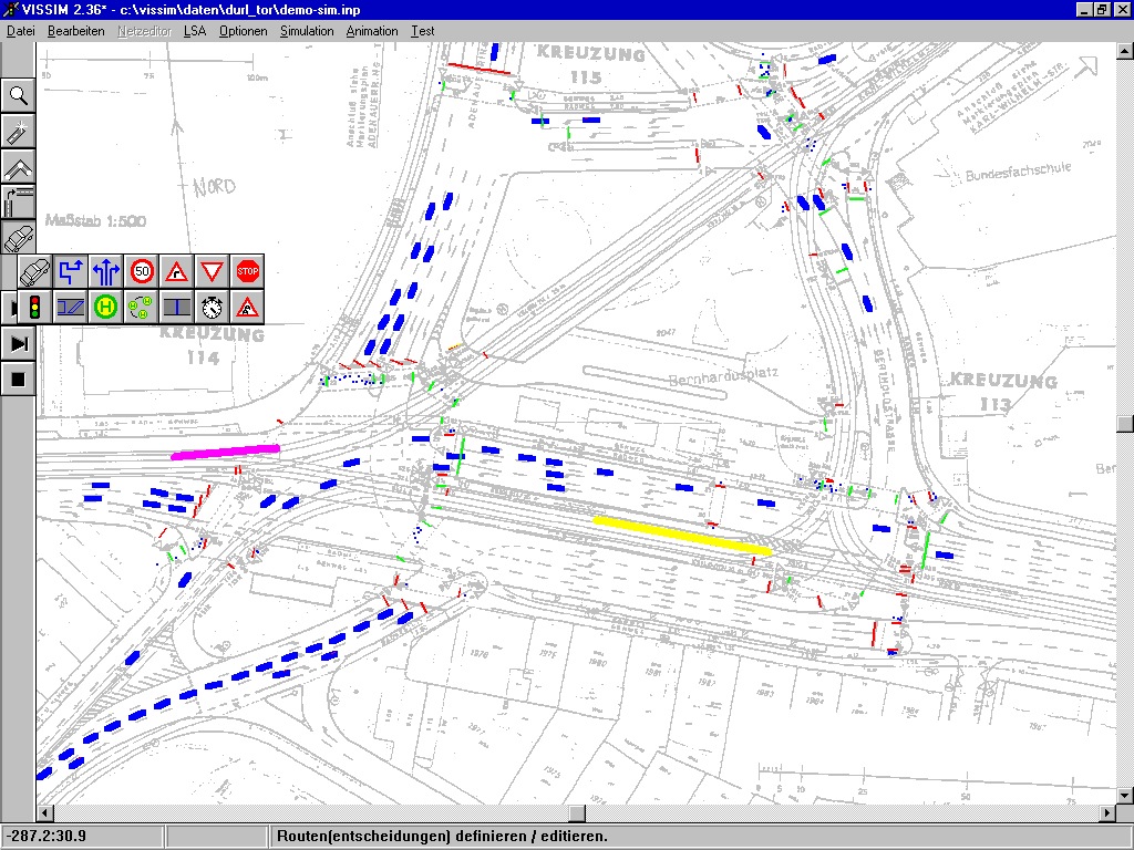
The VISSIM User Interface
Signal control depends on the strategy and controller type used. An open interface is available
that manufacturers can use their specific interface to describe the UTC-logic. VISSIM includes a
flow charter under Windows to describe own local controller logics.
Limitations
The traffic flow model is well suited to model acceleration and speed distributions in queues and
shock waves but using it for Automatic Cruise Control a time step of 1s is too long. Reduction of
the time step requires calibration of the psycho-physical car following model, which has been
done during the DRIVE-project ICARUS but not further developed to meet ACC driving
conditions in urban traffic. VISSIM has no assignment algorithms included; the routes of cars,
trucks and transit are input data. Routes are currently taken from the macroscopic traffic
simulator DYNEMO or static assignment models such as VISUM and EMME/2. VISSIM will
include path building algorithms in the future so that trip chains are used as input. The trip chains
are modelled by activity chain based demand forecasting.
Validation and Calibration
The psycho-physical traffic flow model of Wiedemann and the lane-changing algorithm are the
kernel of VISSIM and have continuously been calibrated and validated on motorways by time
consuming manual analysis of roadside and moving observer films in the 70's and 80's. Lately
the data of moving vehicles equipped with radar sensors plus automatic video detection is applied
to improve the model at stop-and-go conditions and at various types of junctions.
Contact/Distribution Details
For further information contact:
Dr. Martin Fellendorf
PTV system Software and Consulting GmbH
Stumpfstrasse 1
D-76131 Karlsruhe
Germany
Tel. +49-721-9651-302, Fax. +49-721-9651-399, Email: fe@system.ptv.de
WWW: http://www.ptv.de/system
Local distributors are available in Belgium, France, Italy, Netherlands and the USA; addresses
available on request by PTV.
The cost for a full unlimited commercial licence ranges between ECU 5.000 - ECU 20.000
depending on the functionality needed. Research licences or single project licences are available
at reduced cost.
Bibliography
Fellendorf, M. (1994) VISSIM: Ein Instrument zur Beurteilung verkehrsabhängiger Steuerungen.
In: Verkehrsabhängige Steuerung am Knotenpunkt, Forschungsgesellschaft für Strassen-und
Verkehrswesen, Köln, P.58-68.
Fellendorf, M. (1993) Beurteilung des innerstädtischen Verkehrsgeschehens mittels Simulation.
In: Fortschritte in der Simulationstechnik, Band 6, Vieweg-Verlag, Wiesbaden.
Fellendorf, M., MacAongusa, C. and Pierre, M. (1997) LRT priority within the SCATS
environment in Dublin - a traffic flow simulation study, In: Conf. Proc. Urban Transport and the
Environment, Computational Mechanics Publications, Oct. 1997 (to be published)
Hoyer, R. and Fellendorf, M. (1997) Parametrization of microscopic Traffic Flow Models
through Image Processing, Proc. of 8th. IFAC Conference, June 1997 (to be published).
Hubschneider, H. (1983) Mikroskopische Simulation des Individual- und Oeffentlichen Verkehrs,
Schriftenreihe des Instituts für Verkehrswesen, Heft 26, Universität (TH) Karlsruhe.
Leutzbach, W. (1988) Introduction to the theory of Traffic Flow, Springer-Verlag, Berlin.
Wiedemann, R. (1974) Simulation des Verkehrsflusses Schriftenreihe des Instituts für
Verkehrswesen, Heft 8, Universität (TH) Karlsruhe.
Wiedemann, R. (1991) Modelling of RTI-Elements on multi-lane roads. (ed. Commission of the
European Community, DG XIII), pp 1007-1019 Advanced Telematics in Road Transport,
Elsevier, Amsterdam, 1991.
 Back to the Smartest Home Page.